A short film by Marc Rigelsford
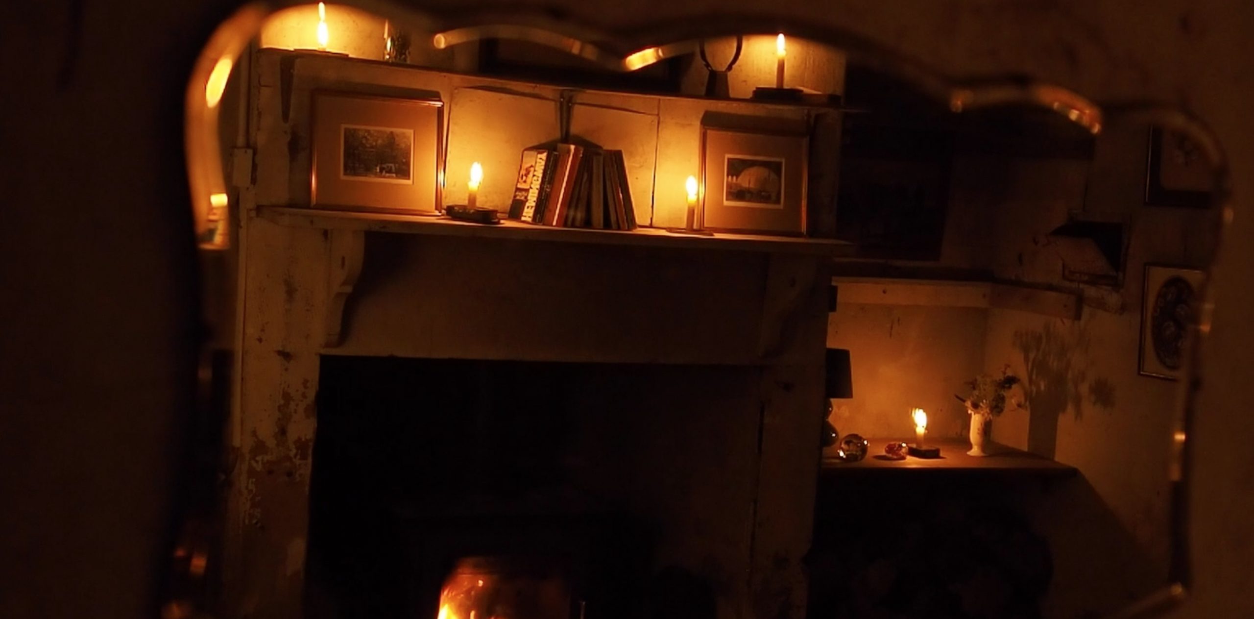
Inspired by the storms of winter 2021/22 and using Ted Hughes’ poem ‘Wind’ as a framework, Marc Rigelsford (aka Magic Arm) has created a new sound piece to explore both the poem’s narrative and personal experiences of the force of wind around Highgreen, home of Visual Arts in Rural Communities, VARC. Musician Holly Lowe narrates the poem and Marc created an atmospheric environment in an old dairy building, complete with a real fire and armchairs, for the work to be experienced by visitors to VARC’s open day at Highgreen in May 2022.
Marc has been producing music for around twenty years. He has released two albums under the moniker Magic Arm and is about to release a third, ‘Dance Mania’.
This work is supported by Visual Arts Rural Communities, VARC, Highgreen Estate, Revitalising Redesdale’s Community Heritage Fund and the National Lottery Heritage Fund.
The Liberty of Redesdale – but in Coquetdale
by David Jones
This article was kindly supplied by David Jones, Chair of the Coquetdale Community Archaeology Group to reproduce here.
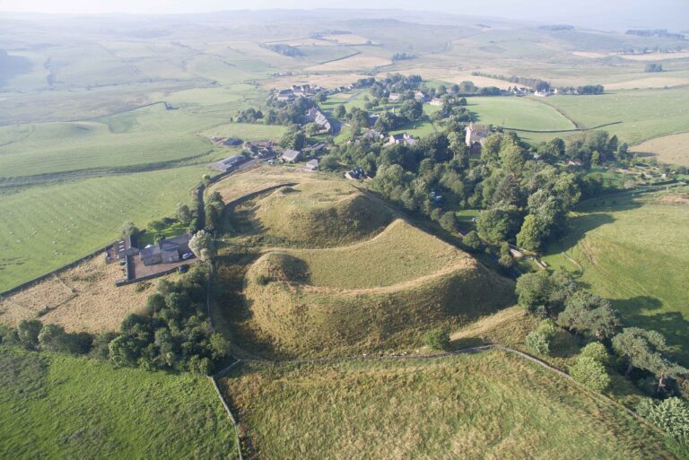
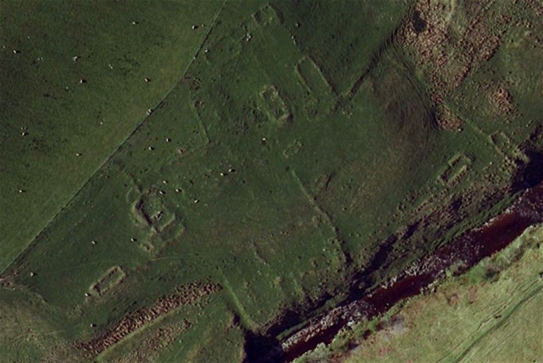
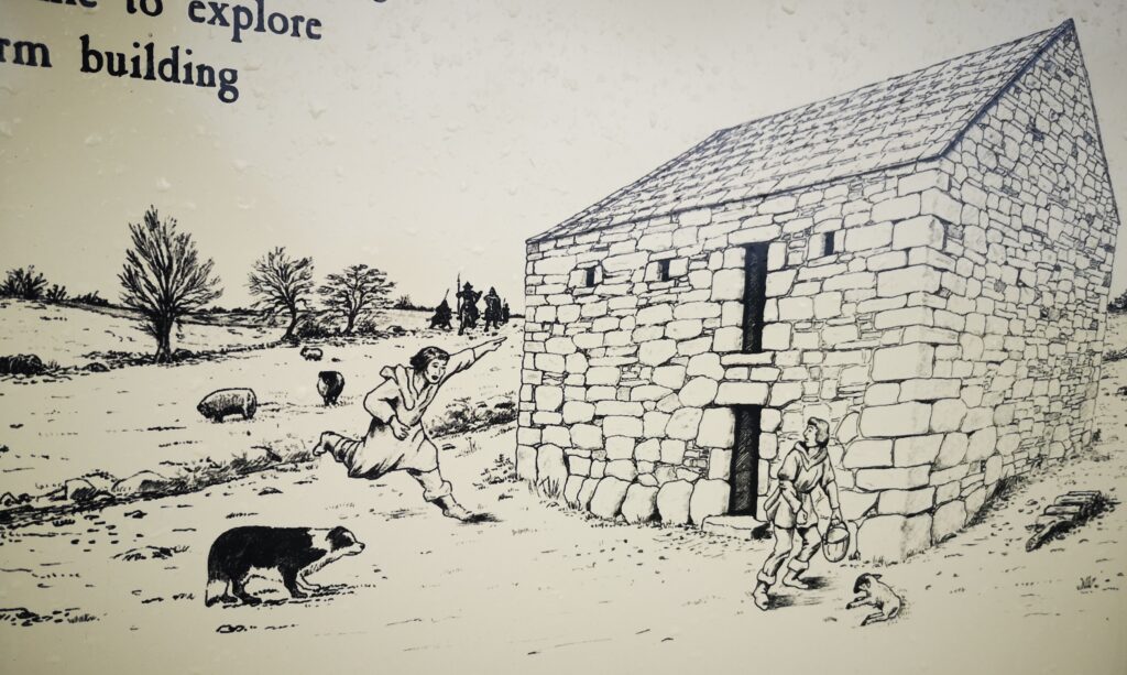
The Linbrig site (right)
As part of their structure of government, in the late 11th century the Norman kings of England started establishing Liberties, areas where they partly relinquished their all-powerful rights as monarchs in favour of a local lord. One of these was the Liberty of Redesdale.
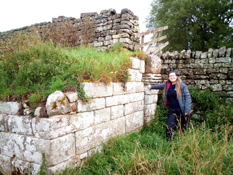
This name conjures up images of the Rede Valley and the surrounding countryside, but the Liberty was larger than that, being essentially the region on either side of Dere Street that controlled access to and from Scotland. Its eastern boundary was in what we now think of as Coquetdale, and much of it ran along the south and west banks of the river Coquet, including places like Harbottle and Holystone. The Liberty lasted for over 400 years: for much of that time its Lords were the Umfraville family, and only in the Tudor period did the area become part of the Middle March.
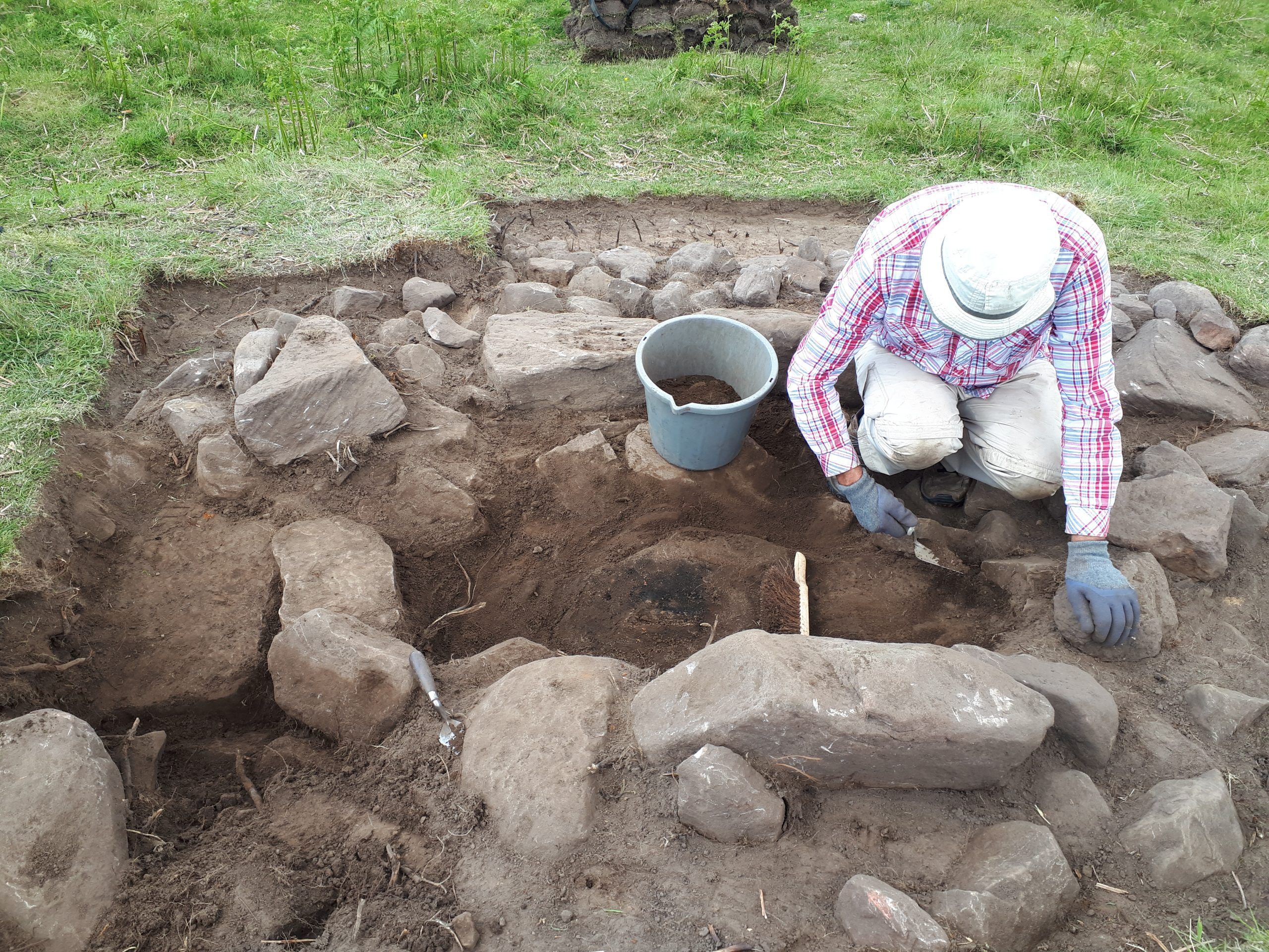
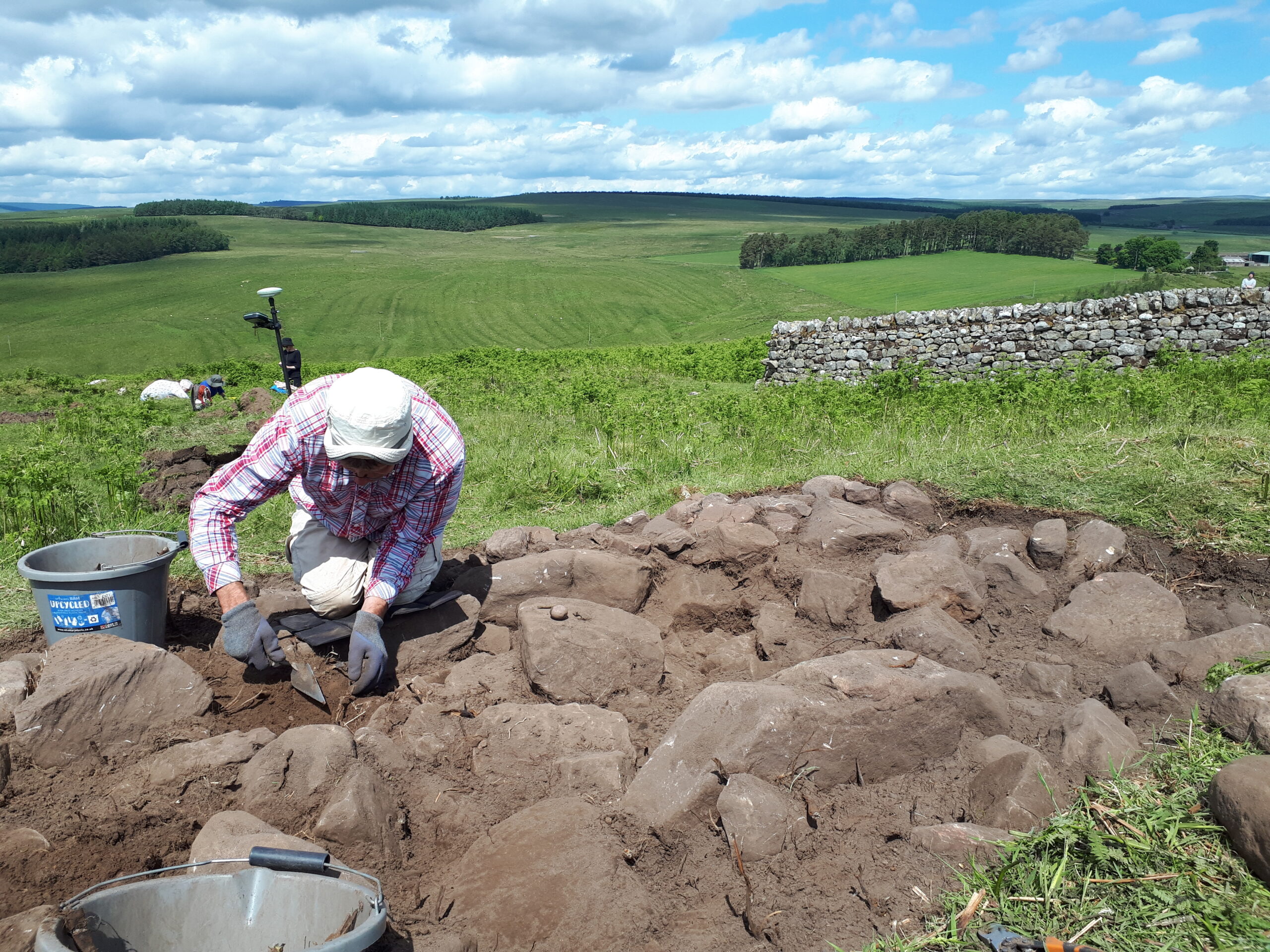
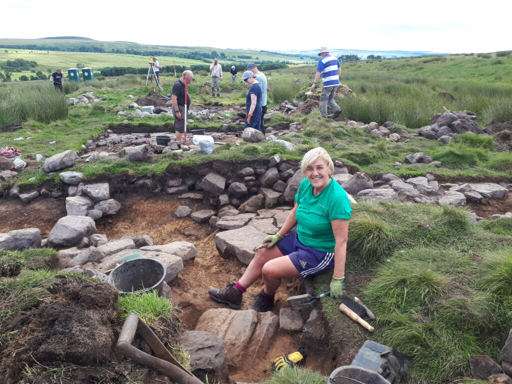
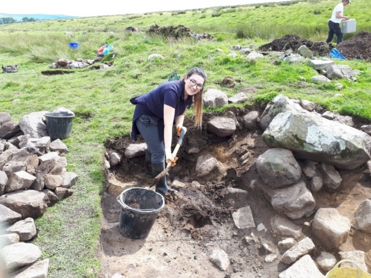
Since 2018, Coquetdale Community Archaeology (CCA) has been investigating a site lying in a bend of the Coquet at the extreme eastern edge of the old Liberty. About 4 km upstream from Alwinton and known as Linbrig, it’s on a farm called Linbriggs and consists of the remains of some 20 structures spread over a little over 1 ha. Somewhat misleadingly, it’s shown on maps as a Medieval Village: this is partly true – it’s certainly medieval – but there’s really little sign of any village-like structure or layout to the ridges and banks that mark buildings and yards. The site is scheduled, and so far three structures have been investigated. One is a grain drying kiln down by the river, while the other two are the remains of buildings that were originally robustly built houses but which seem to have been repurposed for agricultural activity.
Post-excavation work on the kiln is continuing, but there is strong evidence that the fire that dried the grain was on the floor of the kiln itself, and not a short distance from it with hot air being delivered along a flue. Radiocarbon dates from charcoal both on and beneath the kiln floor show activity in the 14th century, and initial studies suggest that oats were the main crop being processed.
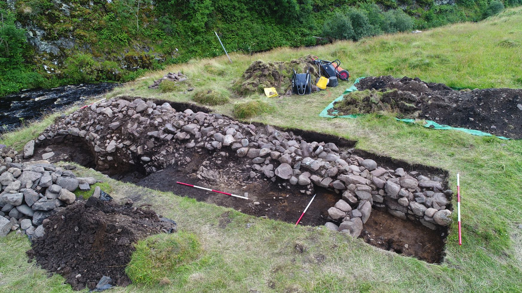
The first of the two other structures excavated was a rectangular building near the north-east end of the site, measuring 13 m by 6 m with walls up to half a metre high. These were robust, consisting of The kiln and adjacent buildings The Linbrig site a mixture of dressed blocks, more roughly-worked stone and some natural boulders. By the south-east wall were the remains of a collapsed gable: when reconstructed on the ground it revealed that it had incorporated a slit window with dressed surrounds. Pottery and radiocarbon dating showed activity in the 14th and early 15th centuries, and a number of building phases were identified, some probably after the building had fallen out of domestic use. For example, a cross-wall had been built on top of an earlier flagstone floor, blocking a doorway in the north-east wall.
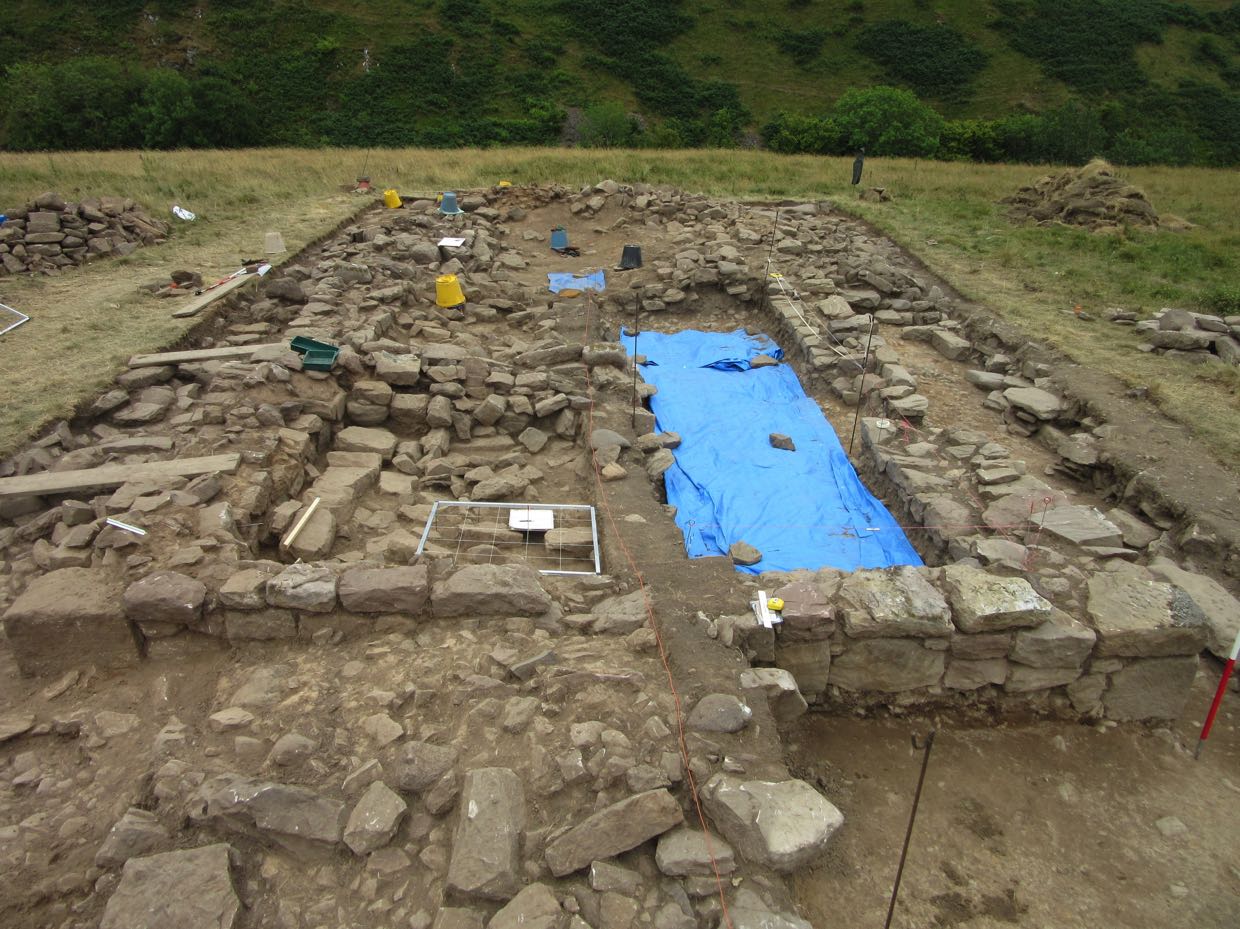
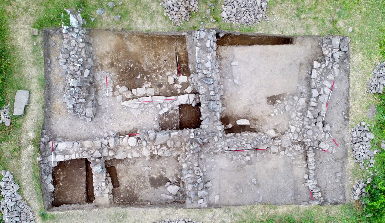
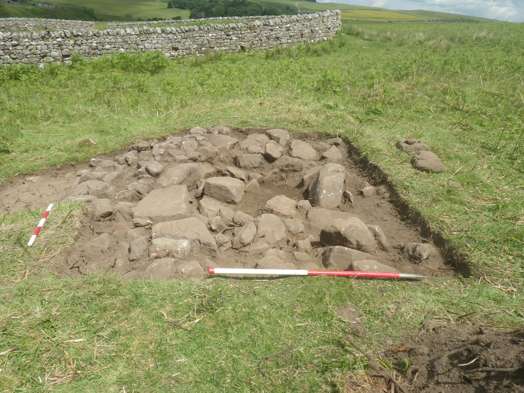
This doorway incorporated blocks that had clearly been re-used, and a lot of similarly earlier stone was identified elsewhere around the building. Some of the quoins were unexpectedly well-dressed, with chamfered corners, and other finds included a voussoir, a length of keel moulded stone and a decorated impost block from the base of an arch. Some of these have been identified as of 12th or 13th-century ecclesiastical origin. The third building, opened in 2021, is towards the south-west end of the site, and is more complex. Before excavation, the ruined walls appeared very substantial and suggested at least three adjoining structures, and after one season’s work we are starting to get some understanding of them.
The large amounts of pottery found suggests 14th-century domestic use, but the building had been modified with substantial later additions. In particular, the remains of some of the original medieval walls had been crudely built up by encasing them with quantities of earth and stone. And it’s possible that a substantial cross-wall is late as well. These changes may date from the late 17th century: post-medieval pot was identified in this wall and the remains of dateable tobacco pipes were found nearby, artefacts that are absent elsewhere on the site.
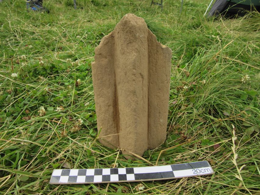
Interestingly, more dressed stone was found, including a chamfered block in one of the walls, part of a window arch and a large curved slab whose function is unknown. So an important question is where did this stonework come from? Some of the stones are portable, but others much less so. A quoin in the building at the north-east end of the site has been estimated to weigh some 750 kg. One possibility is that the source was the medieval church at Alwinton; this was nearly 5 km away by the likely course of the medieval road, which also involved a river crossing. Harbottle castle, which may have had a chapel, was still further away. But there is another, much closer, option.
A Patent roll, dated 25th September 1317, contains the following entry: Licence for the alienation in mortmain by Richard de Horsleye of a messuage, 100 acres of land, 6 acres of meadow, and 20s. of rent in Lynsheles, and Alwinton to a chaplain to celebrate divine service daily in the chapel of St. Nicholas in his manor of Aldensheles for his soul and the souls of his ancestors and all Christians.
This is the earliest identifiable reference to the name Aldensheles and the context suggests that it was somewhere to the west of Alwinton and perhaps in the Liberty of Redesdale. Later references confirm this. On June 5th 1325 an inquisition post mortem entry for Robert de Umframvill lists:
Aldenscheles. The manor held by John de Horsely by service of 1/5 knight’s fee, now worth nothing [by devastation of the Scots]
This sacking of the manor may have been the end of the chapel, because it’s never mentioned again. Later references to the manor identify the Horselys as holding it up to the middle of the 16th century at which point a marriage meant it was transferred to the Carnaby family. In 1663 there is an entry in a list of rates and rentals for Jane Carnaby as owner of Adon Sheeles al’s Quicking Court: for the first time this identifies exactly where the manor was.
Quicking Court – now Quickening Cote – is a still-extant farm on the western boundary of Linbriggs, the farm with the Linbrig site. But the boundary between them has moved relatively recently. An 1846 tithe map shows that Quickening Cote’s land then extended right up to the river Coquet, just like the medieval Liberty, and included the Linbrig site. The boundary change happened in 1911, when the War Office purchased most of Quickening Cote to be part of the Redesdale ranges and transferred an unwanted eastern area of the farm to Linbriggs.
This means that the site CCA has been investigating was once on the manor of Aldensheles, and careful examination of LiDAR and aerial photographs suggests that it was the major settlement there. The group of structures by the Ridlees Burn which is currently (and, we think, wrongly)
known as Aldensheles appears to be little more than a set of shielings and agricultural enclosures.
But we don’t yet know where the Aldensheles chapel was, or if it was on the Linbrig site at all. There is no east-west aligned ruin there, but some local churches (e.g. Holystone) are skewed by almost 20° and the ruined church at Mow in the north Cheviots was some 30° astray. A resistivity survey of the central part of the Linbrig site shows nothing new there. But there is one final intriguing observation. In 1903 a visitor to the area reported that the Linbrig site was being used by farmers as a source of dressed stone, and that local people called it Aydon Sheles or Aydonsheles Kirk. Written records show Aldensheles was still being used as an alias for Quickening Cote in the 1730s, and folk memory can last for hundreds of years.
Was that the case in Coquetdale?
On 25th January 2022 the Revitalising Redesdale team gave an online presentation about the overall Revitalising Redesdale programme so far, including Natural Redesdale and Lost Redesdale archaeology activities, together with Community Engagement and Activity proposals for the coming year. The talk is now available for you to view below and on our YouTube channel.
Interested in finding out more about what we’re up to? Visit our What’s On page to see upcoming events.
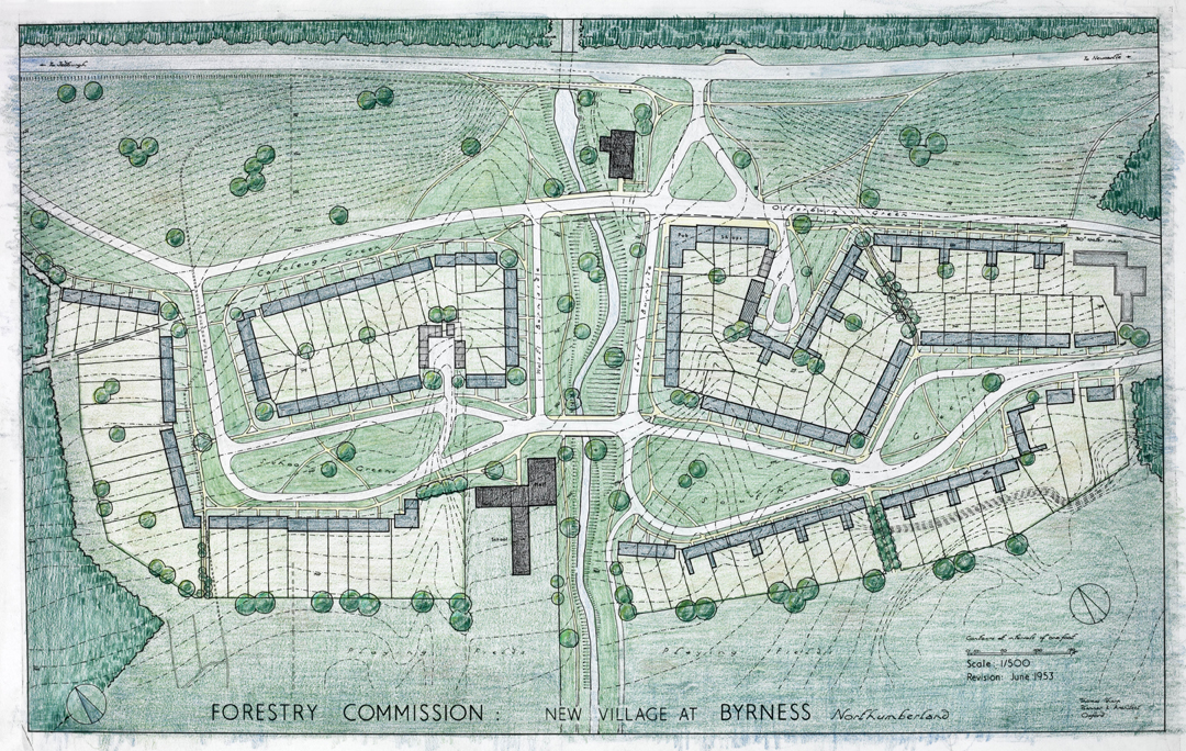
As the forestry industry grew in the early twentieth century, so did the demand for accommodation for forestry workers and their families. One such village was Byrness in Redesdale.
John Pendlebury, Professor of Urban Conservation at Newcastle University, has kindly given us permission to reproduce his article for the Northumbria Gardens Trust about the forestry villages of Kielder, Byrness and Stonehaugh, planned by Thomas Sharp.
Thomas Sharp was a planner and writer of some significance in the middle part of the twentieth century, although he was never in the mainstream. A native north-easterner, raised in fairly humble circumstances on the south-west Durham coalfield, his was an impressive rise in the profession; all the more so due to his tendency throughout his working career to fall out with people! His first polemical text, Town and Countryside, published in 1932, was in part written whilst unemployed as the result of one such falling out. In very brief summary, Sharp celebrated the planning achievements of the Enlightenment period for creating harmonious towns and beautiful countryside. These were inspiration not for imitation but for planning in a contemporary way; for example he believed in a clear separation between town and country and was very scathing about the contemporary planning ethos, originating in garden-city ideas, which created low density suburbia. The way of building in the countryside was not through ribbon development and sprawl but through creating new villages.
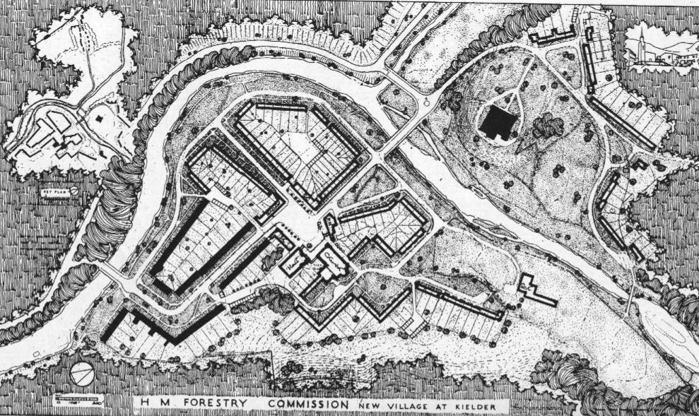
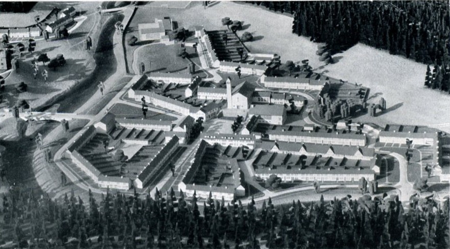
His work in the north-east was primarily in Durham and for the Forestry Commission. In Durham he produced the well-known 1945 plan Cathedral City (part of a slew of such plans he produced at this time for historic cities including Oxford, Exeter, Salisbury and Chichester) and he was employed by the City as consultant advisor for many years subsequently. For the Forestry Commission he was initially engaged in 1946 to masterplan eight villages for its forestry workers (ten had initially been suggested), each of which would house between 350 and 500 people. The forests of Kielder, Wark and Redesdale were undergoing massive expansion and it was anticipated a large workforce would be needed close by. Sharp and others argued that rather than scattered small groups of houses, which had been the policy of the Forestry Commission up until that time, houses should be grouped into villages of sufficient size to sustain community facilities. This was to be a phased work; the Commission decided they immediately needed 150 houses which Sharp recommended be divided between three sites; Kielder (60 houses, adding to some earlier inter-war semis), Byrness (50 houses) and Stonehaugh (45 houses); though these settlements would be incomplete he considered that they would be of sufficient size to give some community and village character.
| Area | Village | No of dwellings | Notes |
| Kielder | Kielder | 200 | |
| Plashetts | 100 | Low priority, site now under reservoir | |
| Mounces | 100 | Low priority, site now under reservoir | |
| Comb | 300 | ||
| Chirdon-Bowen | 100 | ||
| Wark | Stonehaugh | 300 | |
| Redesdale | Rochester | 80? | Long-term village expansion |
| Byrness | 120 |
There were already a number of buildings at Kielder. The castle of course, but also various houses, some built in the inter-war period for the Forestry Commission and mostly located in the Kielder Station area. Though Kielder was an obvious place to develop a village at the outset it was seen to be challenging because of the scattered and disparate existing buildings. There was a debate over whether village extension should take place around the station but Sharp was firmly of the view that it should be on the new site of Butteryhaugh (though there is in practice also some post-war development around the station). The completed plan would have established a more satisfactory visual relationship with the castle than exists today – Sharp orientated one of his informal spaces at the entrance to Butteryhaugh to capture the view up the hill. Byrness and Stonehaugh were virgin sites. Comb was to have been the fourth village, again a virgin site, with a linear plan running along an isolated ridge in the Tarset Valley.
In undertaking his designs Sharp was mindful of his own writings on villages, particularly in his classic 1946 text The Anatomy of the Village and his conclusion that most English villages, especially in the north, have a strongly nucleated form. At the same time he strove for a reasonably organic and non-formal plan, without axial treatments and so on; a kind-of ordered informality. So Sharp planned terraces (he was a great believer in terraces and streets) with occasional semi-formal spaces and focus on community buildings. Building in stone was not possible so he proposed white or near-white colourwash as a finish. In Sharp’s view the frontage of properties was essentially part of the public domain. The modest front gardens in front of houses were to be left open and grassed as part of the wider composition. Private space was to be found in the long rear gardens.
Like so many of Sharp’s commissions things were not to work out as he wished; indeed in his unpublished autobiography, Chronicles of Failure, he goes as far as saying that the Forestry Commission was the worst client he had! This had been an important project to him, ‘I felt that what would most satisfy me in life, what would most justify me ever having lived, what would crown a whole life’s work, would be to build a good new village and write a good, even if very short, lyrical poem’ (p247). Though he was not architect for the houses built he was not unhappy with these (these were by Robert Mauchlen of Mauchlen & Weightman). Rather, the problem was that the works were not continued, as the mechanisation of forestry work and improving communications meant that the scale of workforce estimated to needed on site dropped rapidly. Kielder and Stonehaugh were only ¼ to 1/3 completed – Byrness rather more so and Sharp felt it rather more successful as the part that was constructed was more self-contained – the remainder of the village would have been the other side of a stream (Sharp’s favourite was perhaps Comb, abandoned all together). Furthermore, the Forestry Commission refused to provide the necessary community buildings including basic needs such as a shop or pub and he was often unhappy with details such as bridges. Only after much pressure did they provide £5 or so per village for amenity tree planting!
Visiting the three villages today, the overall planning of the parts that were built, in terms of the combinations of buildings and the spaces that link them, stands up fail well in my view. One suspects, though, that Sharp would not have been too impressed with some of the attempts to personalise both houses and the gardens to the front. At the same time understanding something of the history explains what is so unsatisfying in each case – they are fragments, in the cases of Byrness and Stonehaugh little more than a series of terraced houses, not the complete and coherent villages Sharp wanted. The experience is perhaps most dispiriting at Kielder, however. For at Kielder further development has taken place and rather than using the Sharp plan as a key for growing the village the building has been haphazard and unrelated to what went before, architecturally, but more importantly in terms of siting.
John Pendlebury
Bibliography
Sharp, T. (1932). Town and Countryside: Some Aspects of Urban and Rural Development. Oxford, University Press.
Sharp, T. (1945). Cathedral City: A Plan for Durham. London, Architectural Press.
Sharp, T. (1946). The Anatomy of the Village. Harmondsworth, Middlesex, Penguin.
Sharp, T. (1953). “The English Village.” Design in Town and Village, T. Sharp, F. Gibberd, and W. G. Holford, eds., HMSO, London, 1-19.
Sharp, T. (1949). “Village Design.” Journal of the Town Planning Institute, 35(5), 137-148.
Sharp, T. (c. 1973). Chronicles of Failure. GB 186 THS. Newcastle upon Tyne: 296.
Stansfield, K. (1981). “Thomas Sharp 1901-1978.” Pioneers in British Planning, G. Cherry, ed., The Architectural Press, London, 150-176.
This article also draws upon the Special Collection of Sharp papers, Newcastle University. This collection is currently subject to an AHRC Resource Enhancement Grant.
http://www.ncl.ac.uk/library/sharp/
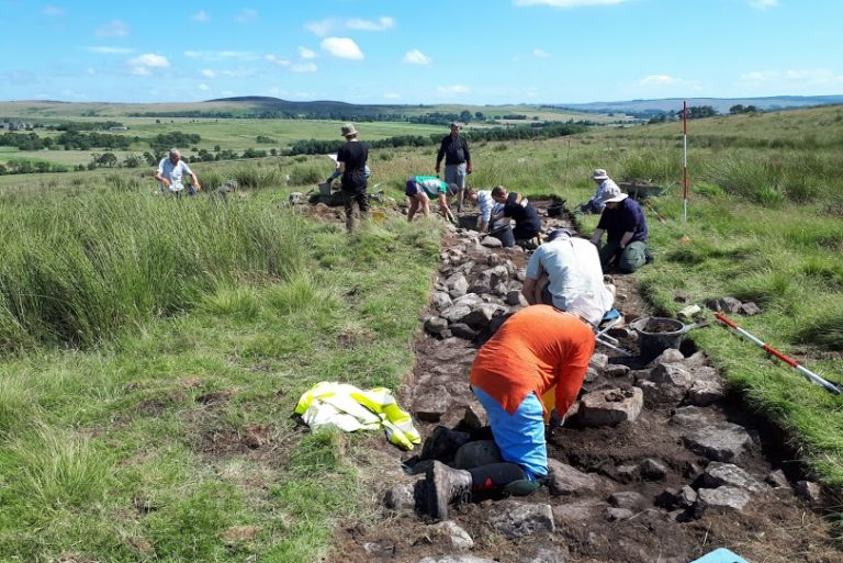
In June 2021, we carried out an archaeological excavation and earthwork survey, to investigate a previously unrecorded possible Iron Age/Romano-British settlement near Yatesfield, a remote upland farm on the Otterburn Military Training Area. Earthworks visible on LiDAR imagery appeared to show a previously unrecognized enclosed settlement, potentially consisting of several roundhouses, circular hut platforms and agricultural terraces.
This was a partnership project between Revitalising Redesdale, the Ministry of Defense (MOD)/Defense Infrastructure Organisation (DIO) and Breaking Ground Heritage and engaged volunteers from the local community and Wounded, Injured and Sick (WIS) veterans and serving personnel from the military community.
A report of the results has now been produced and can be viewed/downloaded here.
The main findings detailed in the report are:
- The earthwork survey demonstrated that the features include an enclosed settlement containing at least two circular hut platforms surrounded by agricultural terraces and roundhouses, with other as yet undated field systems nearby.
- The excavations showed that the enclosure itself was made up of a large stone wall along the southern side which became an earth and stone bank around other sections.
- Within the enclosure, we uncovered evidence of circular platforms, which could be roundhouses with clay floors.
- At least one stone-floored roundhouse was found outside the enclosure around the edge of the agricultural terraces, which were cut/built up to the east of the enclosure running up the hillside. Another possible roundhouse and enclosure was found to the west.
- Organic-rich material covering the stone flagged floor of the partially excavated roundhouse contained burnt plant remains, which returned a radiocarbon date of 40 BC – 130 AD, which places the settlement firmly in the Late Iron Age to Romano-British period.
- This settlement, while only partially uncovered, appears similar in construction and date to the Late Iron Age/Romano-British enclosure and roundhouses excavated at Rattenraw Farm approx. 1.5 miles to the south-west.
Plans are being developed for a return visit to Yatefield in 2022, to try and uncover more of this fascinating site! Further information will be available here and on our social media pages.
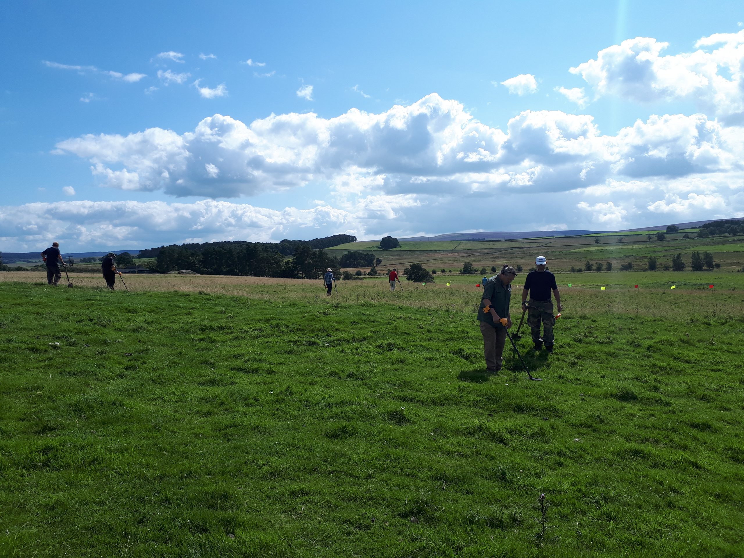
Our fieldwork investigation into the Battle of Otterburn, looking for physical evidence of the battle that took place in 1388, was carried out in August 2021 and involved a mixture of geophysical survey, test pitting and metal detecting survey. A report on the findings of the fieldwork has now been produced and is available to download below.
The main conclusions of the report are:
- Neither the geophysical survey or test pitting identified the medieval road, which was thought to relate to the battle of Otterburn, or any contemporary features/finds associated with the battle.
- However, the geophysical survey was generally successful in determining the presence and nature of archaeological remains across the site. Archaeological features identified included:
- several pit-like features, possibly containing burnt material, adjacent to a scheduled round cairn, which could suggest funerary practices associated with the monument
- a series of ditch-like features that define former land parcels and which are probably from the medieval and post medieval period
- a ditch and bank feature recorded as a footpath on historic mapping, but which may have earlier origins and possibly relate to the scheduled Roman temporary camp at Dargues
- The gradiometer survey also identified several geomorphological features, most notably a series of former river channels.
- The metal detecting survey resulted in the recovery of 68 items. The only items possibly relating to the period around the Battle of Otterburn are a belt buckle dating from the mid-14th to 17th century and a sword pommel recovered from a neighbouring field by a volunteer after the fieldwork had been completed, which is probably medieval or post medieval in date. The centuries long date range of these two items means neither of them can be conclusively linked to the battle.
- The overall conclusion of the fieldwork is that the investigation of the fields available to us at the time of survey have failed to identify any significant evidence that the Battle of Otterburn took place across these land parcels.
If you would like to find out more about the Battle of Otterburn project, we are holding a free online Zoom talk about the project on Thursday 17th February, 8-8.45pm. The talk will be given by the Battlefields Trust and will discuss the findings of the last 3 and a half years of research into the battle as part of the Revitalising Redesdale scheme. You can register for your free place at https://www.revitalisingredesdale.org.uk/events/battle-of-otterburn-conflict-in-a-landscape-online-talk/
Revitalising Redesdale Landscape Partnership is proud to announce the launch of its online radio play, ‘Amid the Hills of Redesdale.’ Written and directed by Rachel Cochrane, its performance has involved bringing local people of all ages together to tell the fascinating story of Redesdale’s history.
The radio play was funded by The National Lottery Heritage Fund as part of the £2.8m Revitalising Redesdale Landscape Partnership scheme.
The play tells the story of the beautiful and remote Northumberland valley of Redesdale from Roman times to present day, with its focus on the forgotten army of workers and their families who came from near and far to build the Catcleugh Reservoir. This community lived on the two banks of the River Rede (nicknamed Newcastle on the north bank and Gateshead on the south) in huts named ‘Black Houses’, so called because they were coated in tar to keep out the rain. Constructed between 1890 and 1905, the reservoir was commissioned to provide water to the booming population of industrial Tyneside.
Inspired by the artefacts and photographs left behind by those who were part of the Catcleugh story, the drama unfolds through a series of monologues, with characters telling their imagined stories of joy and tragedy against a backdrop of brutal hard work and danger. The play drew on extensive research carried out by Northumberland National Park volunteer, Tony Evans, author of ‘They Danced, They Drank and They Built a Reservoir.’ For several years, Tony led ‘Black House’ tours; the last remaining workers’ hut at Catcleugh. The play is also dedicated to the memory of Beryl Charlton, local author, historian and archaeologist, who played the part of Dorothy Temple in the play, and who sadly passed away in July 2021, shortly after recording.
The new Revitalising Redesdale walk leaflets in include a walk to the Black House and other walks in the Catcleugh area. Northumberland National Park Authority run guided walks to the Black House in the summer months – see their pages for more info.
Redesdale Revitalises led by Newcastle University student volunteers ‘Go Volunteer’, is helping new groups to explore and enjoy being outdoors in Redesdale’s tranquil, rural environment. Here’s a report and photos by Mike Duckett from Go Volunteer about their latest activities….
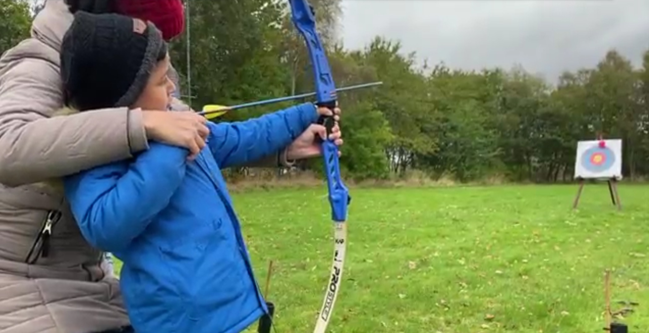
This summer two young people from El Salvador had a chance to spend time in Redesdale as part of a teenagers’ residential. In October an opportunity was spotted to let them introduce their families and others to the area – to show off their experiences and the confidence they’d gained. So a day trip was organised by Redesdale Revitalises with families who are supported by N.E.S.T (North East Solidarity and Teaching). These are families who have a similar shared background but do not know or live near each other, so another purpose of the trip was to give them a shared experience and allow them to feel more connected as a community.
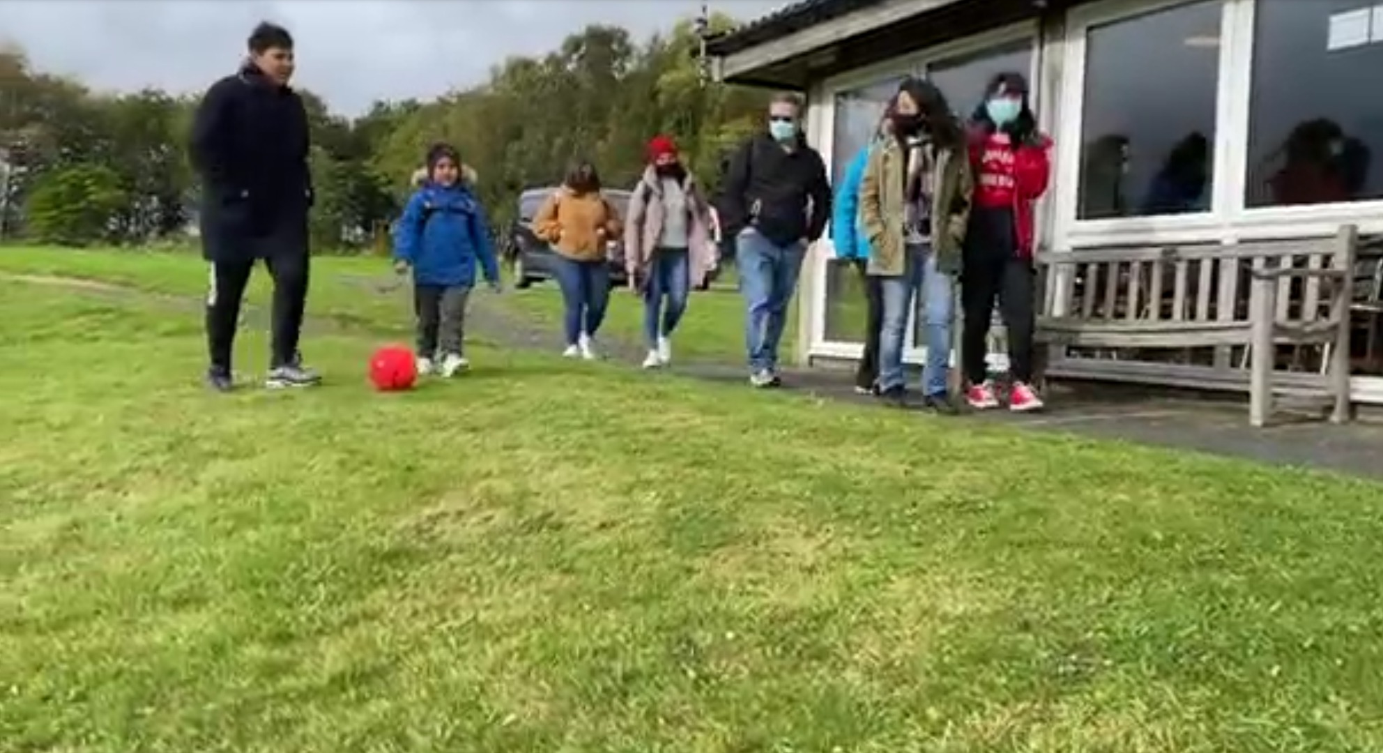
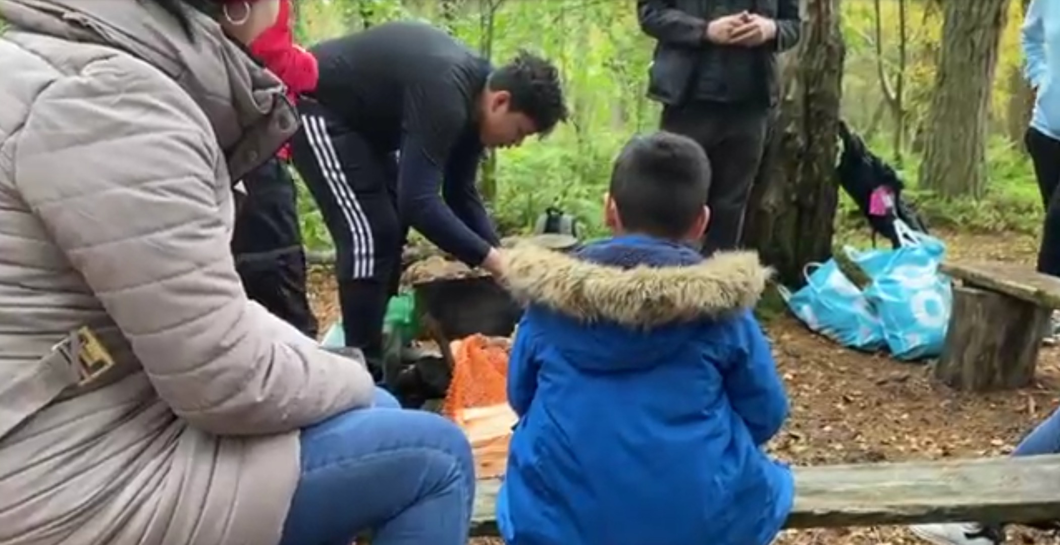
We arranged for local activity provider, John Hartshorne, to set up an archery activity at Otterburn’s RTC centre – kindly opened for us by volunteers, and we ordered a bulk order of pizzas from the Border Reiver shop. Three Spanish speaking University volunteers helped translate during the trip, (especially useful for the archery safety!), and the two experienced young people also did a fantastic job of keeping the chatter on the minibus journey lively so that everyone felt included. It worked really well as a social trip, and the archery was something that everyone – from 5 year old Jason to the adults alike – really got into. When the pizzas arrived it was hard to stop the competitive spirit as everyone aimed for the target board balloons and beating their personal bests. Some participants brought food to share, and then we moved on to our second Redesdale location of the day, Rupert’s Wood.
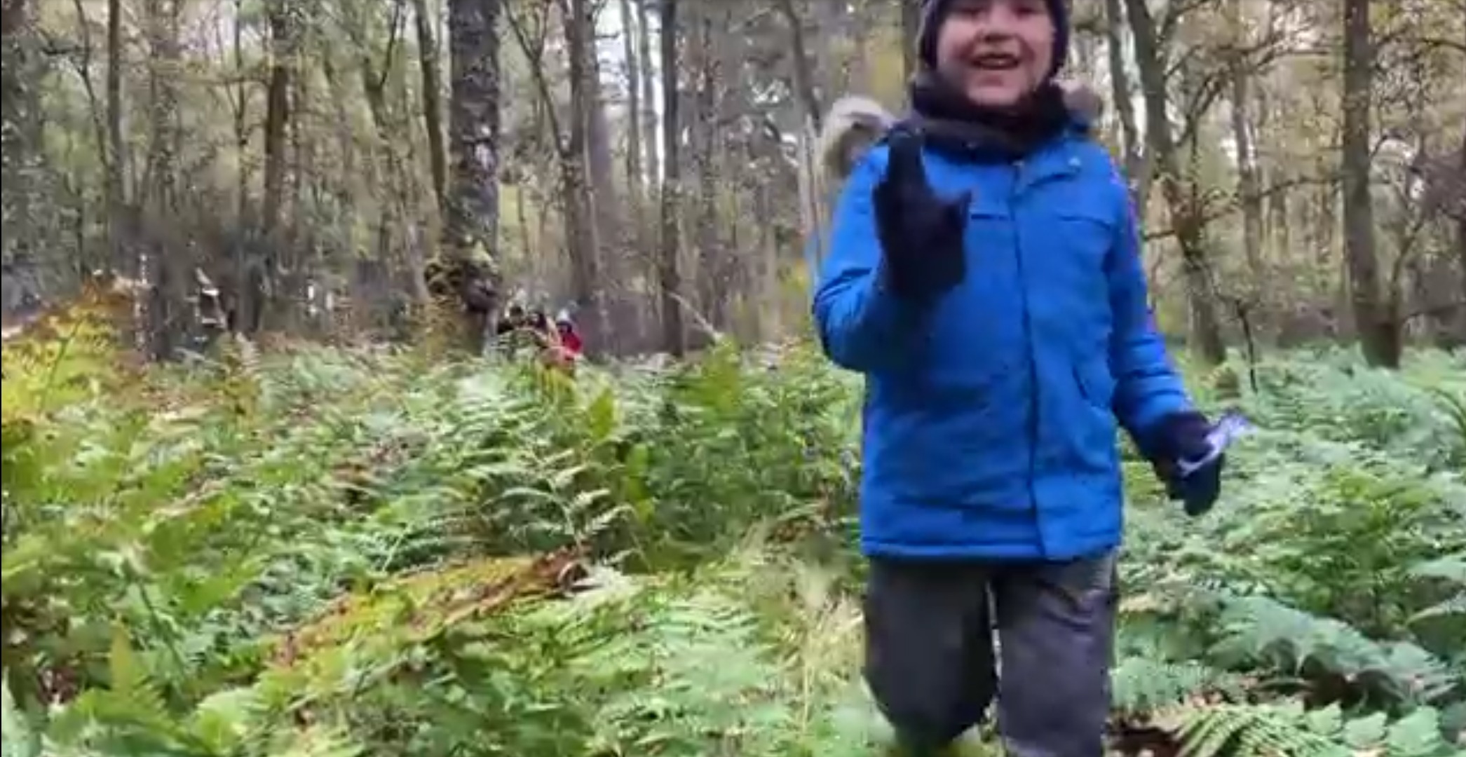
In summer we’d used the woodland for fire and games and getting safely lost in the high bracken. The young people had been led on a circuitous and confusing route through the head-high vegetation, manoeuvred into a stream crossing to get them helping each other (or facing the challenge in their own way), and then once disoriented, they had been given the challenge of finding their independent way back to the fire site. This time, the two young people were instructed to repeat the challenge and their smart young brains immediately and accurately followed the original random route around the camp. With their families following them, they selected an easier stream crossing and led the column of followers in a loop past the original point of return, across a big ditch, until yes, they got lost in a wild wood in Redesdale. We gently led them to ramble through the undergrowth back to basecamp where the whole group gathered around a fire we made together. Sticks were sharpened for marshmallows as the music and singing started. What’s more, the weather was kind to us right up to the point at which we had to leave Redesdale.
Bridget Stratford made a video of the experience, following the perspective of the youngest member of the group, 5 year old Jason. The young people who attended are now pestering us to organise a Christmas trip back to Redesdale, and we are probably going to let them succeed in this.
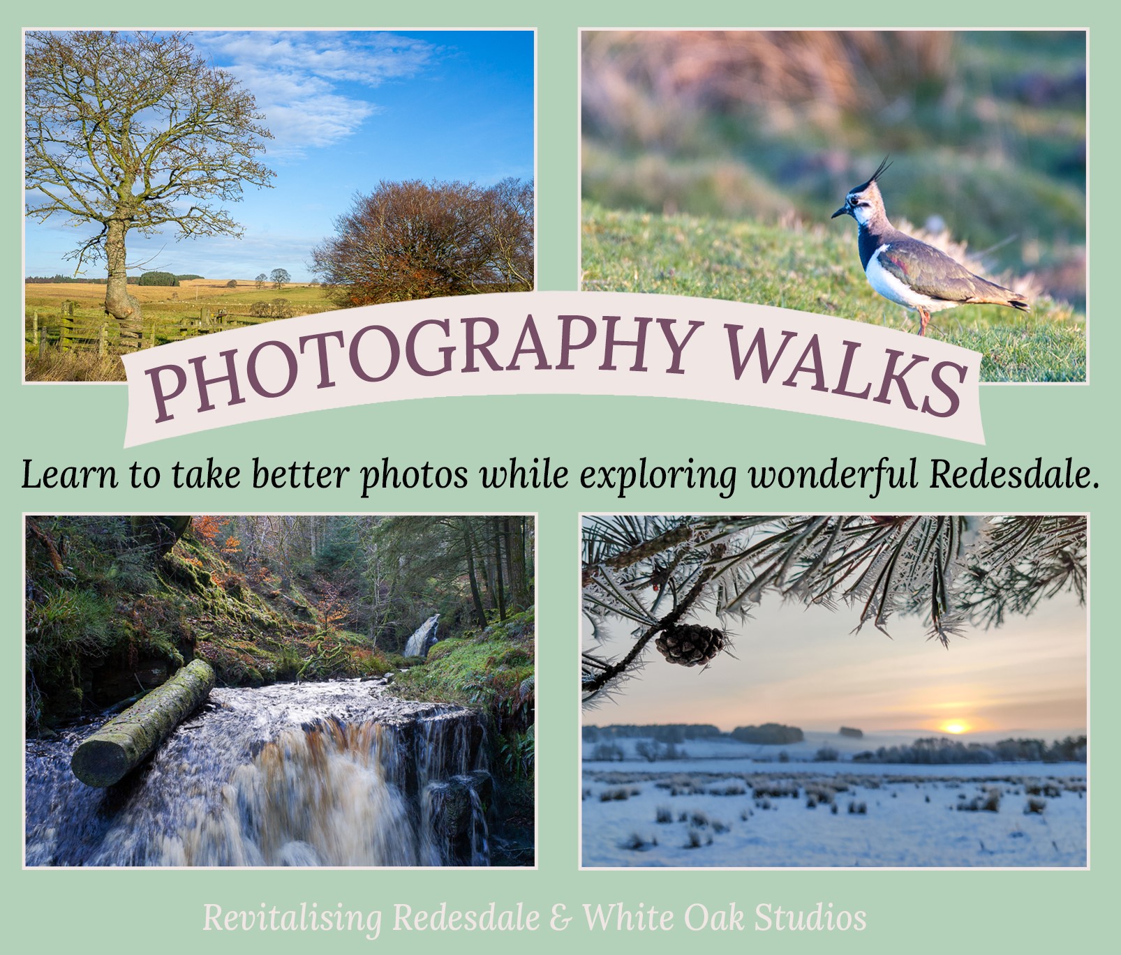
We’re excited to share the details of the first photography walk by White Oak Studios, part of one of our Community Heritage Fund projects, with more walks planned over the coming months! It’s the first walk of the Autumn 2021 series, with further dates below and future season’s dates to be announced.
The first walk of the first series of photography walks in Redesdale takes place this Saturday, 16th October in West Woodburn. Walkers and photography beginners or enthusiasts alike are invited to attend one or more walks to photograph the landscape, flora and fauna. You need not be an expert in photography or even have a camera (your phone is fine!).
Christine Woodcock will lead the walk and show you wonderful sights to capture and offer ideas and technical tips. The
groups are limited to ten, making the sessions supportive and informative.
Tickets cost £10. For further information, please visit www.whiteoakstudios.org/walks.html. To book a place,
please email Chris at chrisfromwhiteoakstudios@gmail.com or telephone her on 07737 518867.
Autumn 2021 dates
Saturday 16th October 2021: Woodburn
Saturday 23rd October 2021: Otterburn Village Trail
Saturday 30th October 2021: Elsdon Village Green
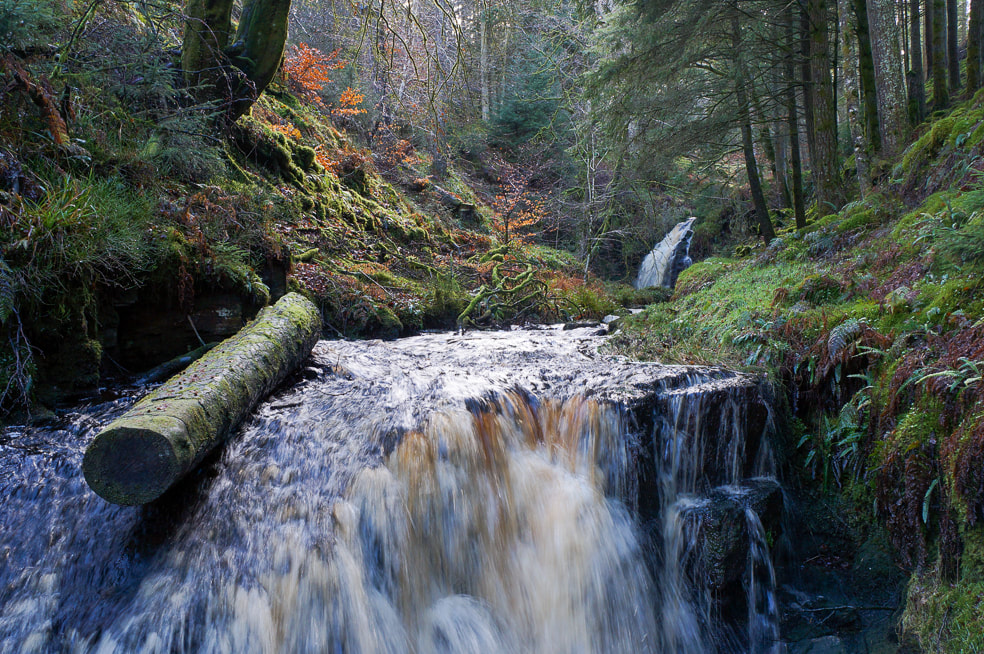
Saturday 6th November 2021: Hindhope Linn & Three Kings
This walk series is organised in partnership with Revitalising Redesdale Landscape Partnership and The National Lottery Heritage Fund.
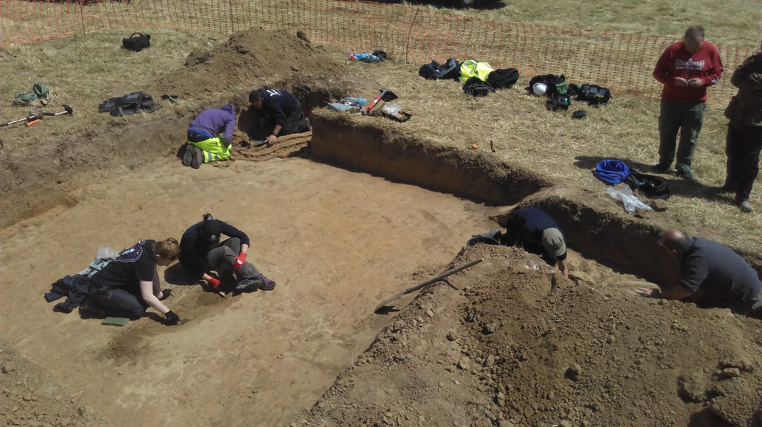
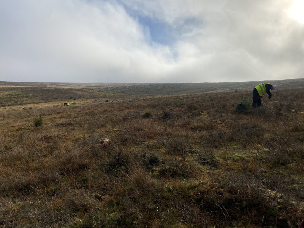
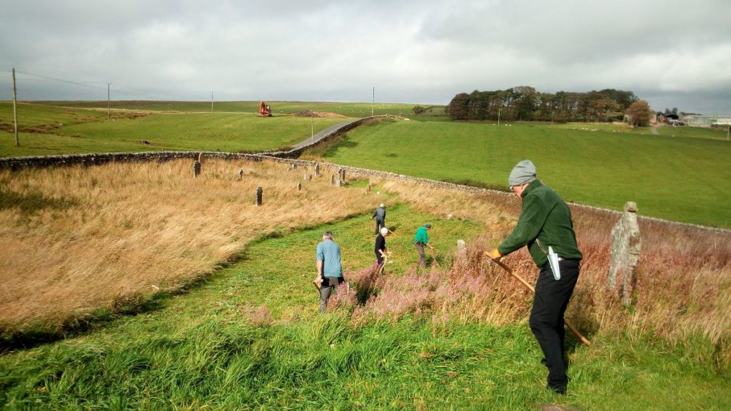
Phil Bowyer explores the developments in one trench during a recent Revitalising Redesdale archaeological excavation. Over to Phil to give his perspective of the event in this special guest blog.
‘During the recent Revitalising Redesdale exploratory excavation at Yatesfield on the Otterburn Ranges, I discovered how much can change in the interpretation of a trench over just three days.
On the first day of the dig led by Wessex Archaeology, I had found a piece of shaped flint and after a day off I returned on Wednesday to be told by Ben, the dig leader, that it had been identified from his photo as a probable Late Neolithic/Early Bronze Age blade by Phil Harding of Time Team fame. However, rather than getting the chance to get back into the trench that had contained the flint I was asked to start de-turfing a new trench across a bank further up the slope. Andy Curtis and I duly set to on what appeared to be a fairly mundane length of stony bank running along a possible platformed area.
By the end of the day we had exposed a stony bank and flat area with a few stones above. It fitted the initial thoughts about a banked platform.

The next day Ben set us onto clearing back the flat area at the top of the bank. By lunch time we had exposed a few more stones and Ben was wondering whether we could have double-faced walling with a rubble infill.
Andy and I were keen to explore a bit further and Ben was content for us to do so. With quite a lot of trenches to back-fill on Friday and it now being Thursday afternoon we thought this would be our last chance to find out anything further. As we were troweling down and removing some small stones I came across a rounded pebble unlike any of the other stones. It had a central white-ish, possibly quartz, band running around it.

This interesting find roused our interest. Soon after we uncovered what appears to be a cupmarked stone. Peck marks were visible which suggests that it is not an erosion feature and that it had not been exposed to the elements for a long period. This in turn suggests that it was a deliberate deposit rather than a random field stone thrown into a wall.

As can be seen from the above photo, and the one that follows, we had also started to uncover a number of larger flat stones at a similar level. It was all starting to look less like a wall and more like…what? As you will know if you have been involved on archaeological digs, there is plenty of room for speculation and this is one of the things that keeps you digging. Often during a dig the speculations can far out-number the quantity of finds!
Our excitement was raised further when Andy started uncovering a quite large area of black material at the same level as the flat stones. We by now certainly had enough to have Ben paying close attention and he decided that we needed to take a good sample of Andy’s dark material.
The combination of the pebble, the cup-marked stone, the flat stones and the dark material inevitably gave rise to thought of whether this could be a burial monument. The conjunction of banks and burial monuments has been found at various locations so such thoughts were not unreasonable.

At the end of the afternoon everyone was gathered around the trench and discussion centred on questions of what sort of burial structure did we have here. There was a high level of excitement. As excavation leader, Ben was being understandably cautious about jumping to conclusions. As this week was an initial exploratory excavation of a large and complex site and the final day would need to be concentrated on recording and back-filling, he was reluctant to commit to further digging, but eventually sanctioned a little further careful exploration on the final morning.
As Andy was unable to attend on Friday, I was joined by Wayne for a last bit of careful excavation. Given that we thought that the feature could well be a burial monument it was important to proceed cautiously so as not to miss anything of significance. Small darker patches emerging had to be checked out carefully, but we encountered nothing that was extensive enough to require more sampling and we encountered no artefacts. However as we proceeded we exposed further large flat stones and it became clear that we had quite an extensive paved surface. Our would-be grave was turning into part of a possible roundhouse!
So there we have it. Over the course of two and a half days our trench had gone from a platformed bank to a double-faced wall and then a grave and ended up as a probable roundhouse. Assuming we will be able to return to this site at a later date I’m sure that among other things we will be extending this particular trench…and who knows what we will find!

The Yatesfield site is large and complex and shows signs of multi-period features. It was unknown until Revitalising Redesdale volunteers undertook a Lidar survey with Paul Frodsham. It offers great potential for a lot more investigation. I’m sure that we will all await the Wessex Archaeology report on this first exploratory week and look forward to an opportunity to return to this fascinating site.’
Thanks to Phil for this very interesting guest blog! If you want to join in on our upcoming archaeological excavations keep up to date via our events page.
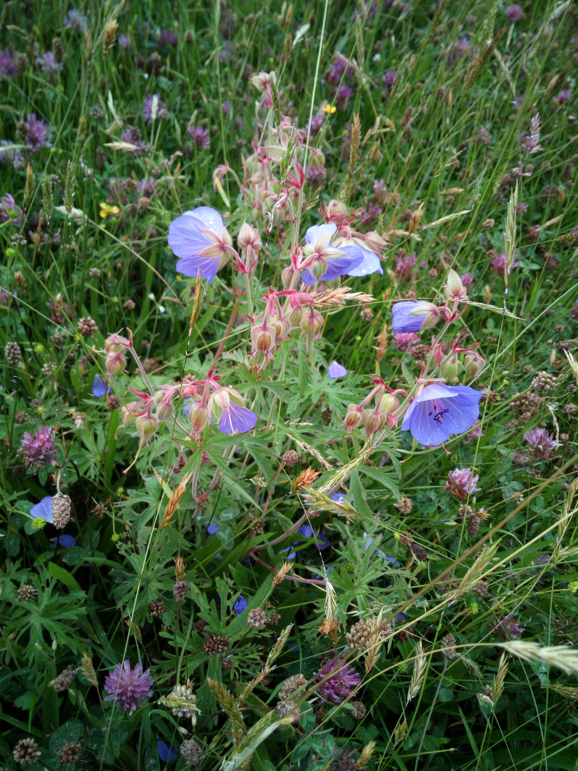
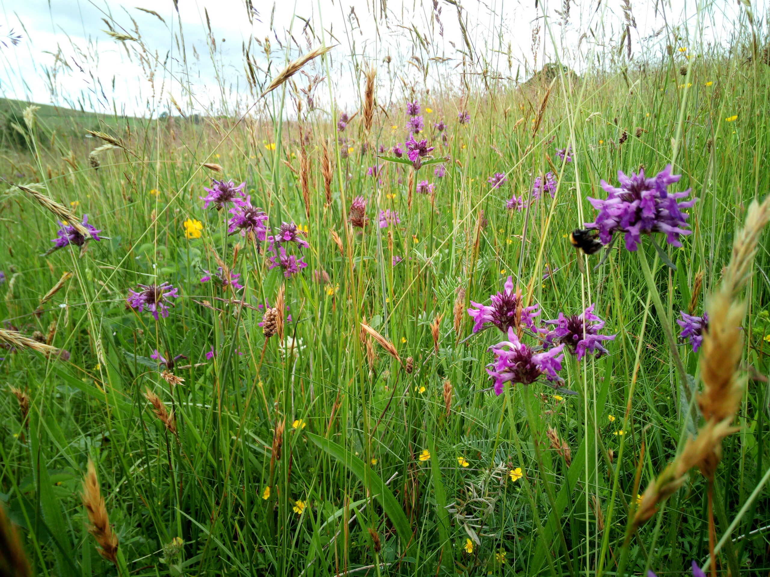
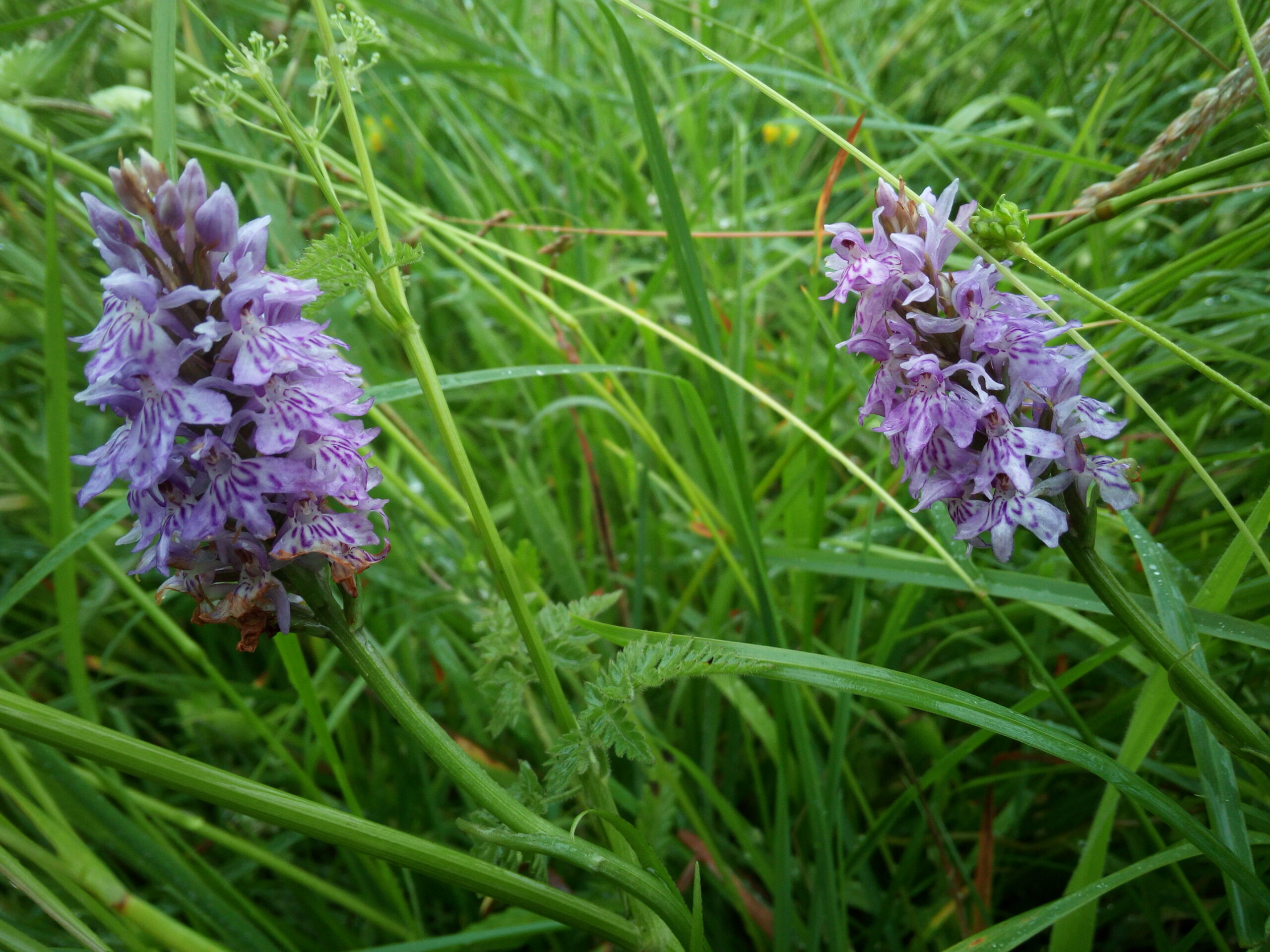
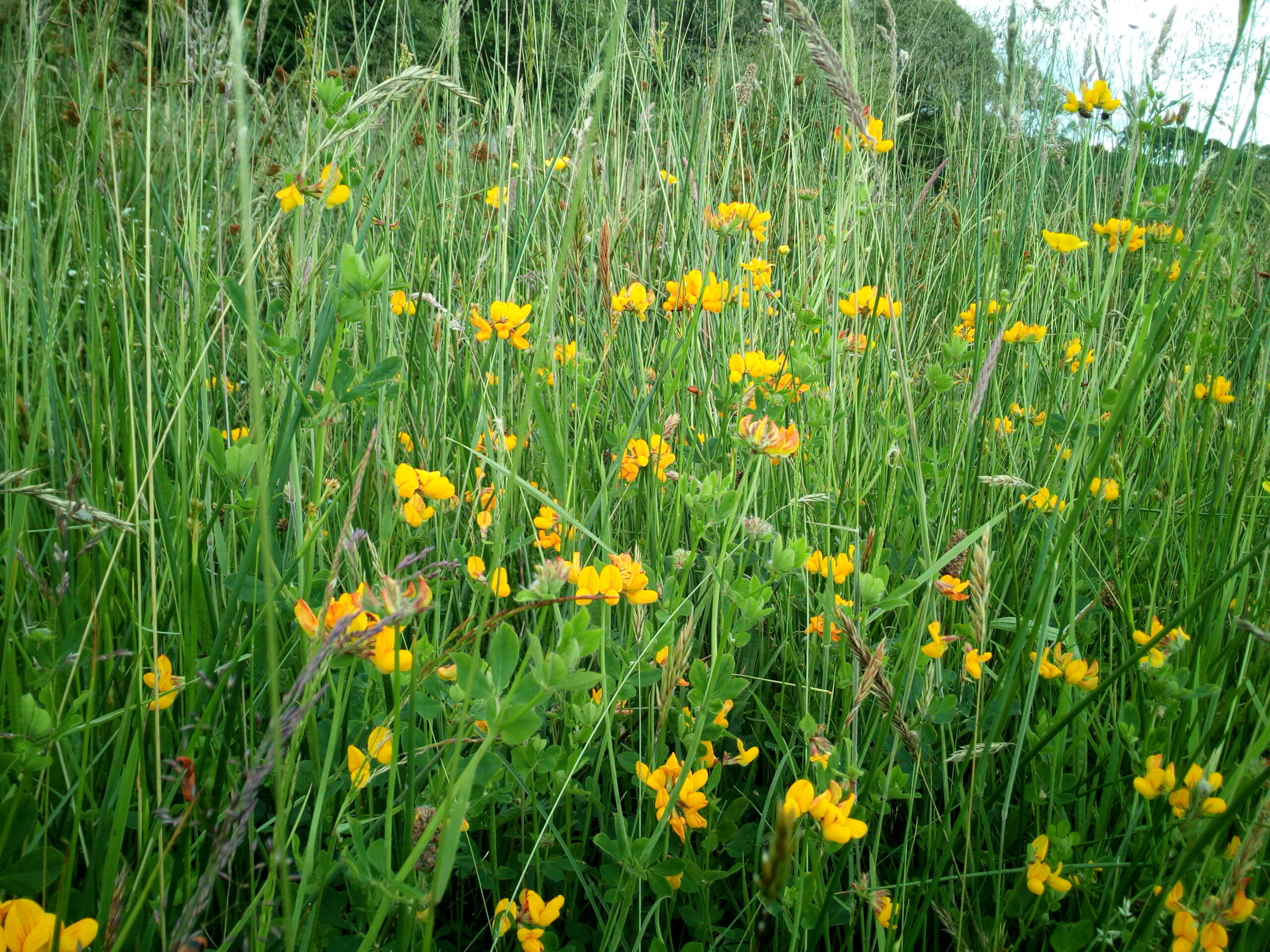
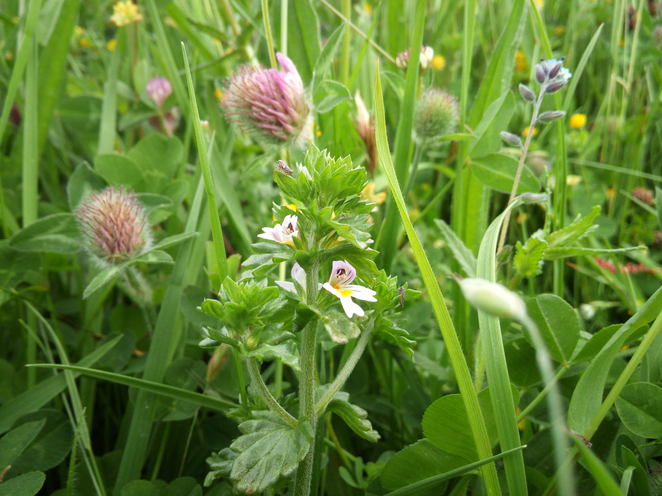
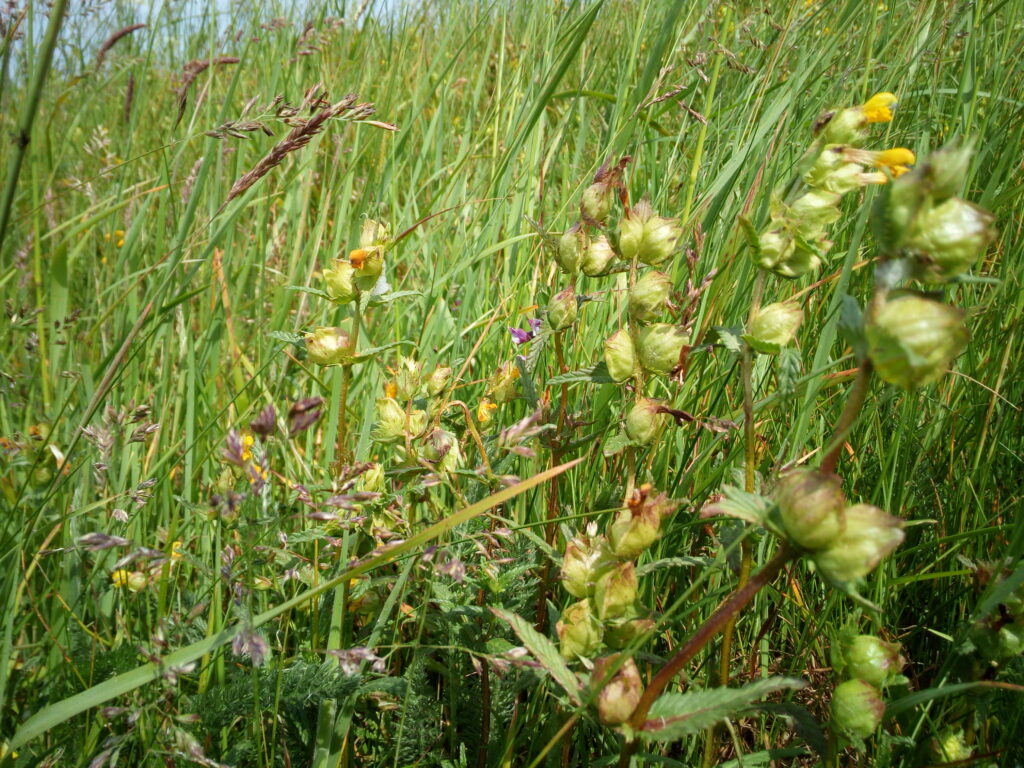
We’ve recently been out surveying some of Redesdale’s meadows in preparation for helping to enhance them through our Re-flowering Redesdale project. To do this we introduce local provenance wildflowers that are typical of a Northumbrian meadow but are currently missing. However, the first step of this is to find out what’s in our meadows at the moment, so we can work out which wildflowers we need to add!
Some of our great recent meadow wildflower finds include:
Have you spotted any of these (or something else)? You can record your wildlife sightings with the Environmental Records Information Centre North East at: http://www.ericnortheast.org.uk/recording-wildlife-2/ You just need to know what you saw, when you saw it and where. If you have a photo then even better!
Revitalising Redesdale’s Assistant Project Officer Natasha highlights the importance of peat and gives an insight into peat restoration work happening within the valley.
It won’t come as a surprise to most of us that peat is important for our planet, to store huge amounts of carbon – peat bogs must be kept in good condition or we face losing these carbon sponges, contributing to further global warming. National campaigns to stop the extraction of peat for compost is a real hot topic at the moment, so please do your bit and go peat-free in your garden!

Our peat bogs are also hugely important for wildlife, from the carpets of sphagnum mosses to cotton grasses, and bog specialists like sundews, cloudberry and bog asphodel. These plant species support a vast range of birds, butterflies and reptiles. At Whitelee Moor NNR in Redesdale, the heather moorland supports merlin, buzzard, hen harrier, skylark and meadow pipit, as well as providing breeding ground for dunlin and golden plover. The latter I have had the pleasure of watching from afar while they find the best place for nesting.
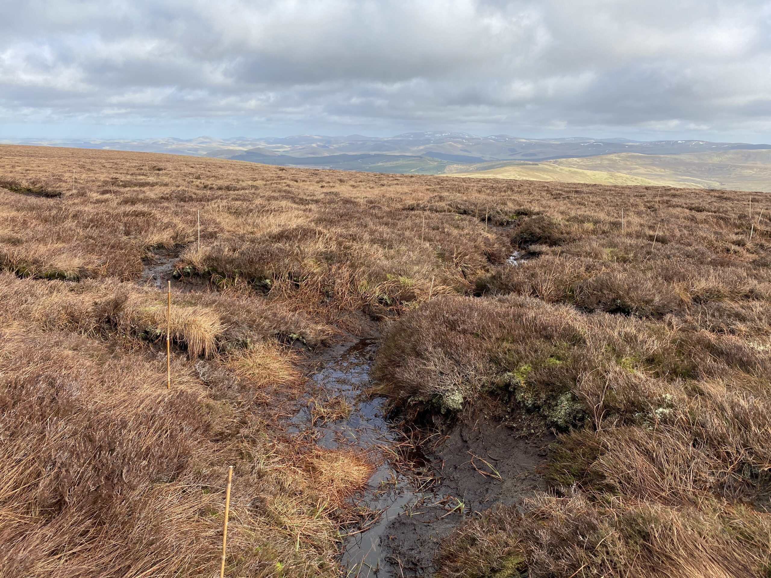
Healthy bogs also filter water through the peat and soak up rainwater to reduce flood risk. Our peat restoration work within Redesdale is clearly hugely important. With our partners at Northumberland Wildlife Trust we are working to improve the quality of the valley’s peatland for the benefit of all, through ecosystem services and providing vital habitat for wildlife.
So how did we do it…?
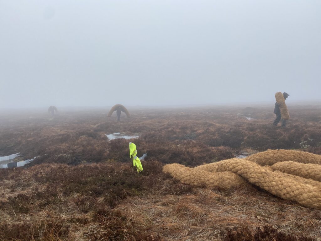
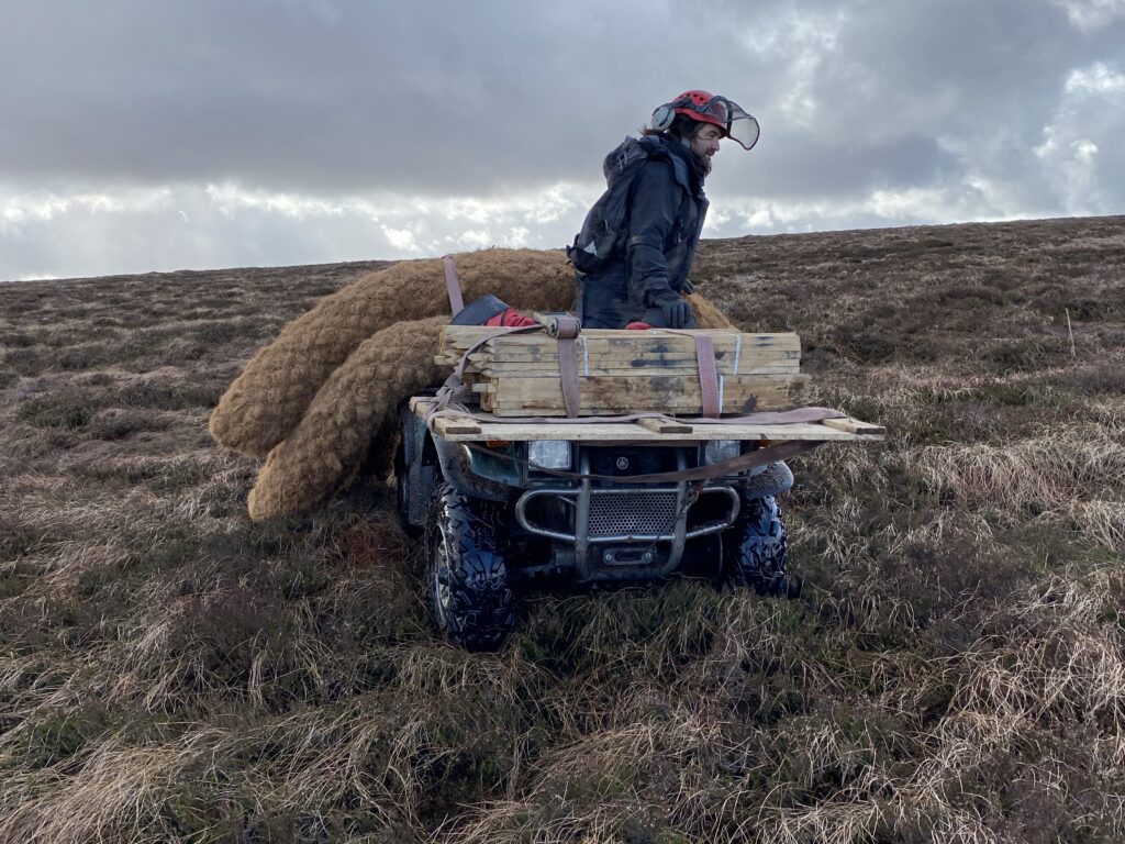
Peat restoration at Whitelee Moor NNR this year happened back in February/March. We carry out work in winter to minimise disturbance to birds that nest here during the spring. Pulling off huge projects like this on a site as remote as Whitelee, presents a multitude of challenges. We faced tight funding deadlines; a lack of helicopter availability to transport materials onto site; and of course everything winter weather throws at you 500m above sea level. With a great deal of planning, adaptability and a little tenacity we managed to complete the project with time to spare. The success was mostly down to the huge efforts from volunteers, staff and of course NWT’s trusty quadbike, ‘Quentin’.
Here’s Geoff Dobbins, NWT’s Senior Estates Officer to explain more:
‘Time for an unsung hero of the Trust to step in, one of the longest serving members of the team, unloved and forgotten at the back of a barn. Who needs a helicopter when you can sprout coir wings, it’s time for ‘Quentin Vroom’ to save the day. We managed to complete the installation of over 700 coir dams and sphagnum planting well within the deadline – thanks to all the staff and volunteers who responded to the call to arms and braved the border ridge (sphagnum planting in February is not for the faint hearted, the sight of icicles hanging from Duncan Hoyle’s beard sums it up).’
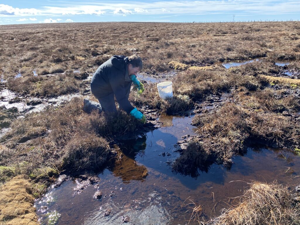
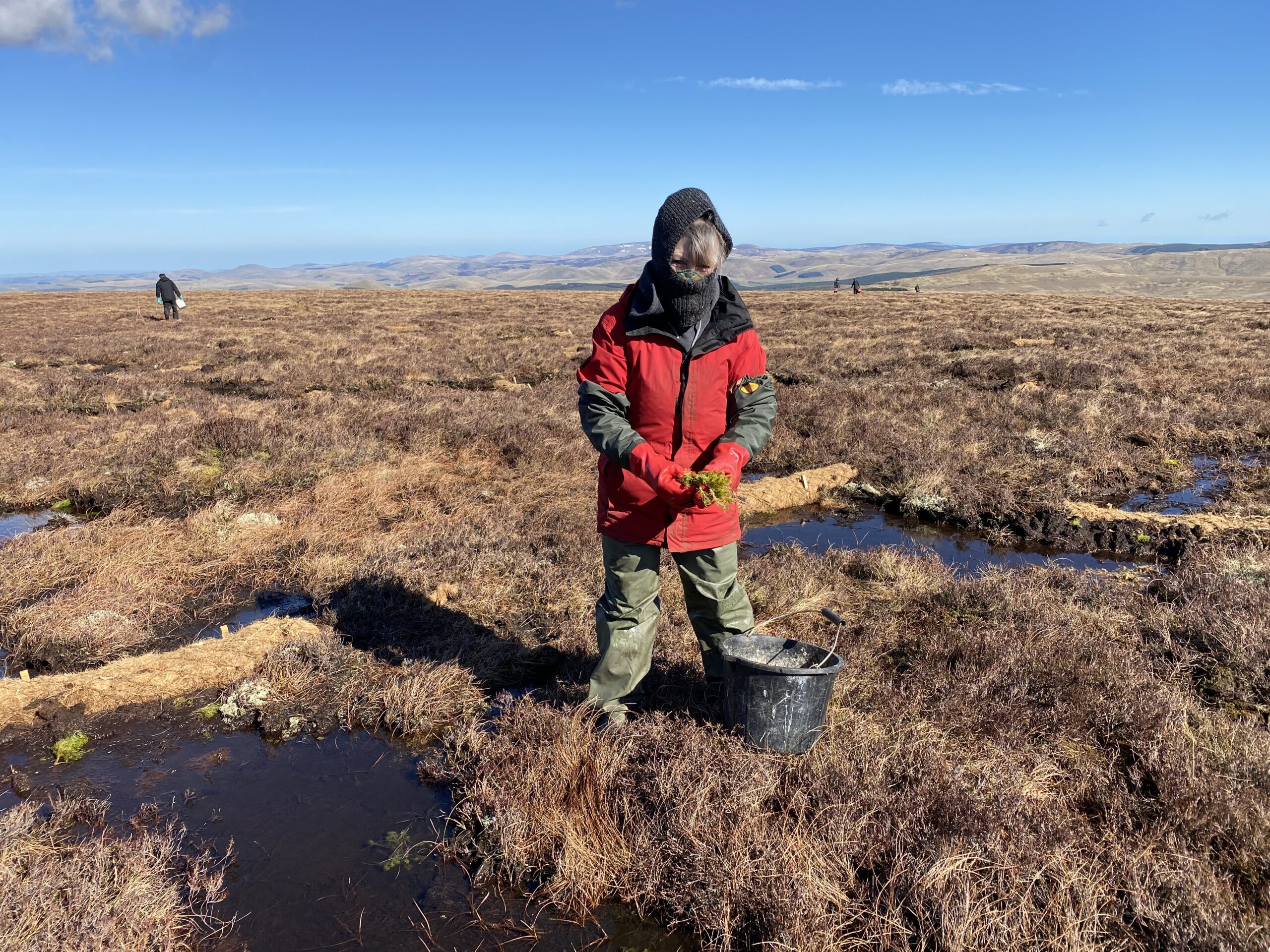

Coir logs, long sausage shaped netting stuffed with coconut fibres, were used to dam eroded peat at the very top of Whitelee Moor. By installing small dams, runoff will be reduced (and therefore erosion), and instead, this creates pools of water which promotes sphagnum moss growth. Ultimately, this will aid peat production in the long term, as peat is created as sphagnum moss and other vegetation partially decomposes in waterlogged conditions. Peat only accumulates at an extremely slow rate (0.5 to 1mm each year!), making it incredibly important to preserve.

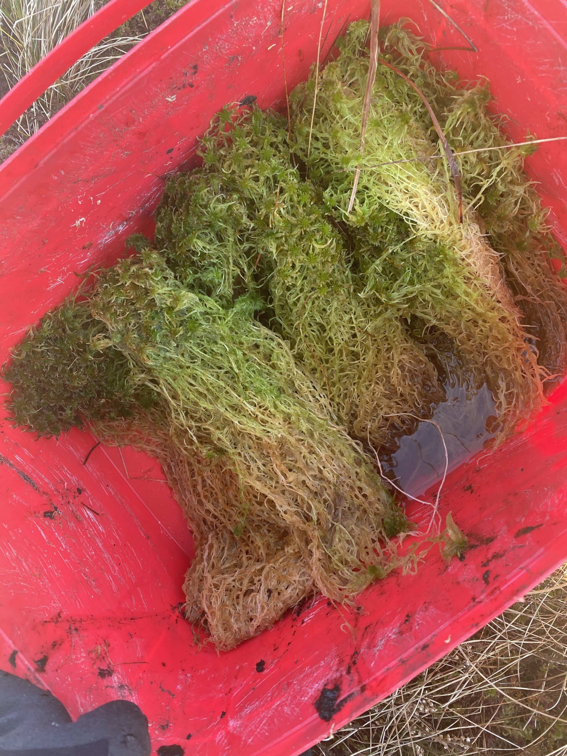
We also translocated sphagnum moss from areas at Whitelee Moor with successful moss growth, and planted the sphagnum in pools behind our installed coir logs. See the video below of how we harvested the sphagnum onsite.
Further work is planned up at Whitelee Moor in the coming winter season, so keep an eye out for updates.
All photo and video content credit to Natasha Hemsley.
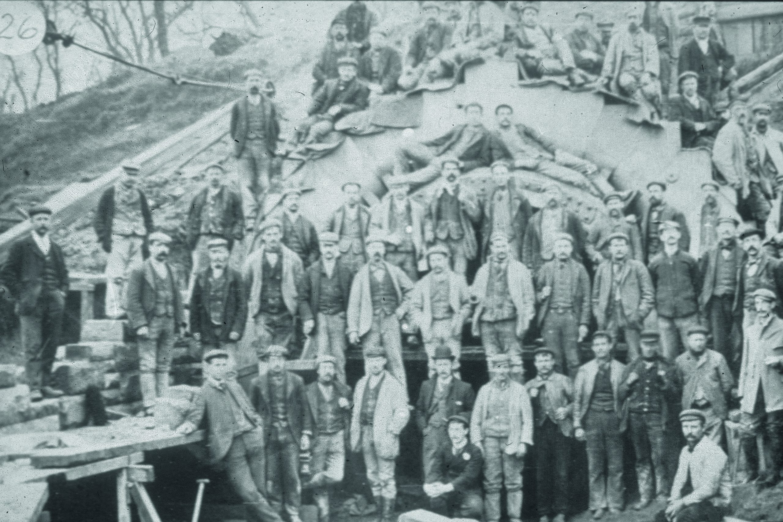
This talk, given by Alex Sotheran, Archaeology Advisor for the Ministry of Defence, focuses on recent (2017, 2018 & 2019) excavations at Bullecourt, in France where Mark II tanks attacked German positions whilst supporting Australian soldiers in 1917. The site was excavated and revealed some surprising and clear evidence for the tank attack which over turned the previous commentary about the battle. The project was also staffed by volunteers made up of ex-forces veterans suffering from various physical injuries and PTSD and helped their recovery through the Operation Nightingale programme of archaeological works.
You can view a recording of the talk on the link below. Please note, viewing is restricted to over 18s as it contains images of human remains and some (mild) swearing.
Well, what’ve we been up to this month? In spite of the extra precautions introduced to keep everyone safe, the Revitalising Redesdale Team and Partners have managed to keep projects going, and even get the ball rolling on some new ones! Over to Trainee Assistant, Natasha Hemsley…
By far the biggest task I’ve been involved with this month has been creating a path at Whitelee Moor National Nature Reserve, up at Carter Bar on the Scottish Border. I managed to join in a couple of weeks into construction, so the gravel section of the path had already been laid by Northumberland Wildlife Trust staff and volunteers!
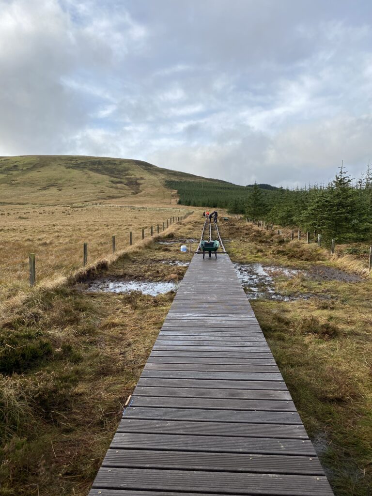
The major effort of this task is putting in the boardwalk: imagine trying to knock in posts with a weighty fencing mell hammer whilst standing up to your ankles in squelchy bog, oh, and it’s raining too!
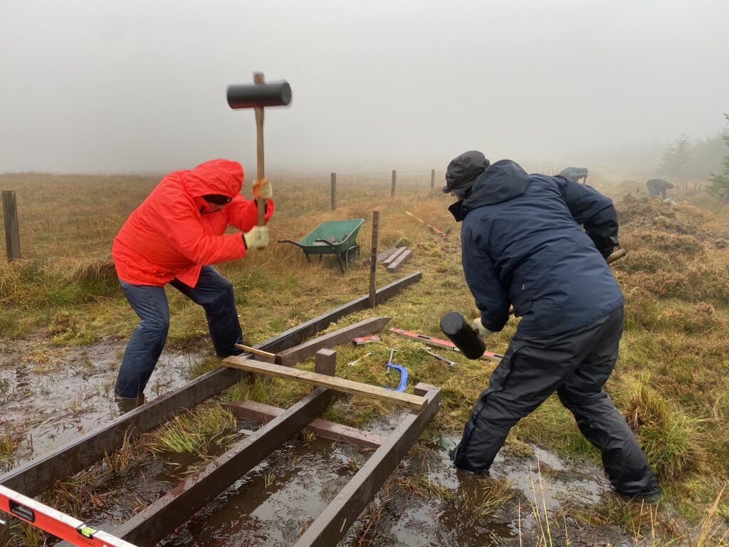
Though true for a number of days up at Whitelee, on a clear day the views are incredible and well worth it!
When the boardwalk is finished, it will enable better access to the top of Carter Pike and cairn, as well as to a fantastic sculpture (watch this space), avoiding difficult to pass boggy patches along the route. This will be a great place to stop and look over Catcleugh Reservoir and down the valley, to enjoy whilst on a lovely weekend hike, or to break up a car journey over the border to and from Scotland.
As the winter months approach, now is the time to start a programme of work on our peatland sites within Redesdale. Days spent removing non-native Sitka Spruce, that have shot up in the landscape over the last year, will keep us busy for a little while. There are more plans in progress for the interesting and hard work of peatland restoration this winter.
So this is some of what the Revitalising Redesdale team and I have been working on over the last month. We are very fortunate that some projects/partners have been able to continue working over this difficult time with extra safety measures in place. We look forward to updating you on these and other ongoing projects in the near future!
Written by Revitalising Redesdale Trainee Assistant, Natasha Hemsley.
We’re very excited to share the news that Redesdale will be the subject of BBC Radio 4’s Open Country on Thursday 3rd December at 3:00pm! It will be repeated on Saturday 5th at 6:07am and on the BBC Sounds website.
The programme will explore the Revitalising Redesdale Landscape Partnership, featuring peatland restoration at Whitelee Moor National Nature Reserve; the improvement of the River Rede for people and wildlife including freshwater pearl mussels and the Battle of Otterburn. Tune in to discover the rich heritage that makes up this wild and beautiful landscape!
For more details visit the BBC Radio 4 Open Country website.
Revitalising Redesdale has continued to make progress this year on the catchment-wide effort to improve the River Rede for wildlife and people. Enthusiastic farmers and land managers are helping the partners to re-establish natural river processes, capture sediment, create wetlands, plant trees and manage grazing. Partners also rebuilt the historic Smoutel Ford, allowing walkers and riders to enjoy trails between Monkridge Hill and Otterburn for the first time in decades.
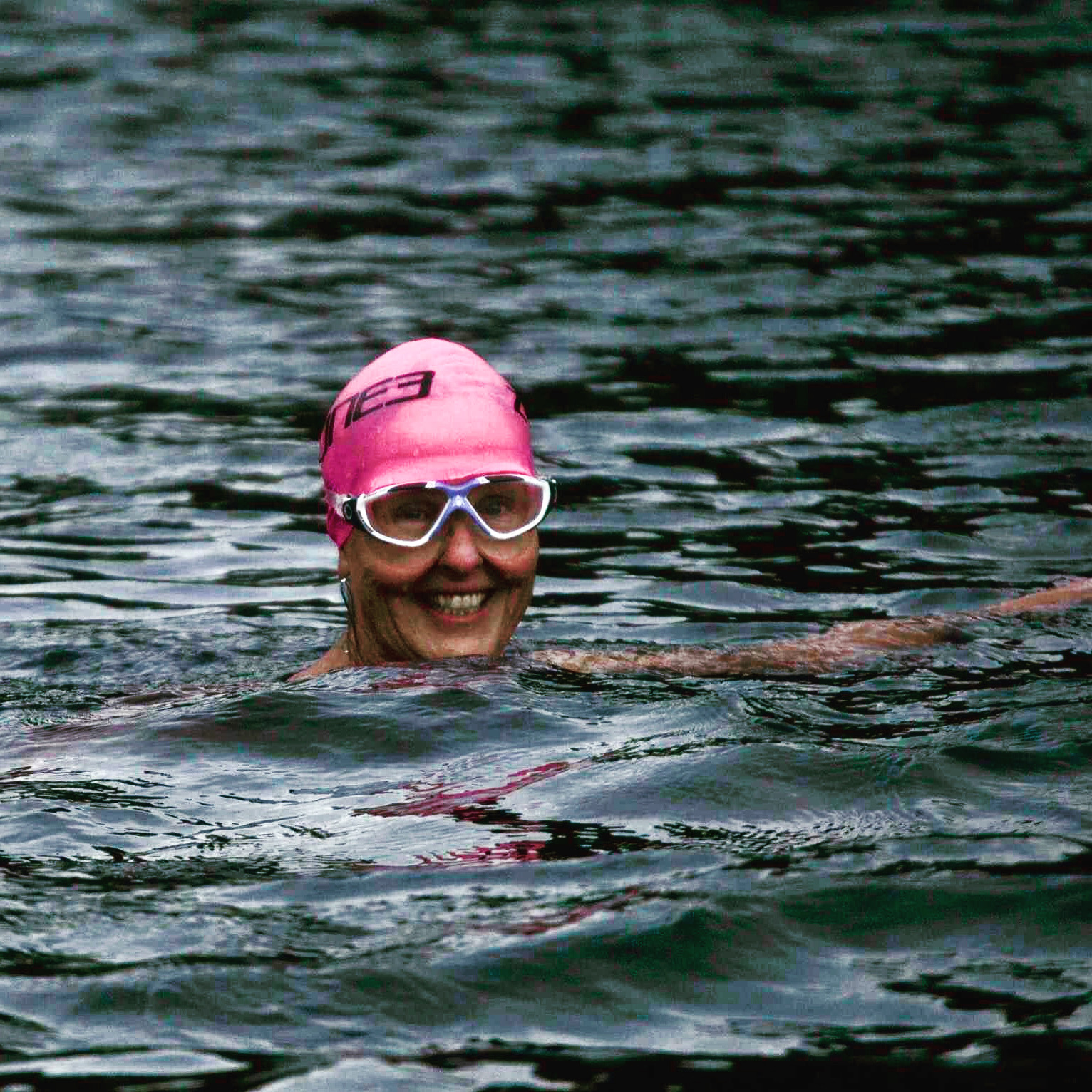
We were very excited to hear what a close connection local artist Mary Ann Rogers has with the Rede. Here Mary Ann shares how she finds a different perspective of the River when she’s away from the easel…
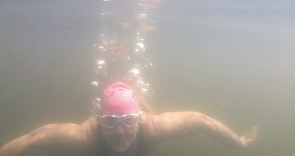
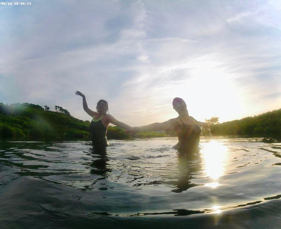
What do artists do when they’re not painting? It’s a commonly asked question. The first place to look might be in the River Rede, as I am a keen outdoor swimmer. One of five children, spending our weekends and holidays by the sea, we swam every day regardless of the weather or temperature of the water. When not swimming in the sea, we would search out pools in rivers like the famous Linhope Spout, at the head of the River Breamish, for daredevil jumping and swimming under the waterfall.
Living in West Woodburn, the River Rede is temptingly close, and it has many quiet, safe pools and stretches of deep water to enjoy swimming in. A summer adventure included a swim, while the level was high following heavy rainfall, from the bridge at Otterburn to the restored Smoutel Ford at Monkridge Hill. This type of swim gives a unique opportunity to see wildlife at close hand. River dwellers are less wary of swimmers than walkers and it’s not unusual to observe salmon, mallard, teal, goosanders and kingfishers. The encounters with wildfowl and other creatures are magical.
I swim in the Rede all the year round. Last week we saw a heron, plus a salmon leap clean out of the water! As the weather gets colder, the swims get shorter. In freezing weather, it’s not unusual to break the ice in the regular swimming pool but only for a very short dip, maybe just a few minutes. It’s essential to listen to your body, to get out before early stages of hypothermia kick in, then get dry, dressed and warm as fast as possible.
Wild swimming is not for everyone, but recent research seems to indicate that cold water swimming can prevent dementia as well as being beneficial for mental health; just the thing for artists.
Editor’s Note: Our thanks to Mary Ann for her photographs and for giving us permission to share her article from the Redesdale and Three Kirks News newsletter (Issue 104: Monday, 2 November 2020).
This year has been eventful to say the least, but we are delighted to be able to share a positive project milestone with you – we’re officially halfway!
We’re very proud of what we’ve managed to achieve so far in celebrating and protecting the heritage, landscape and wildlife of Redesdale; working through partners and local people to conserve, enhance and improve understanding of the River Rede catchment. As you can see from the fabulous graphic below, it’s certainly been busy!
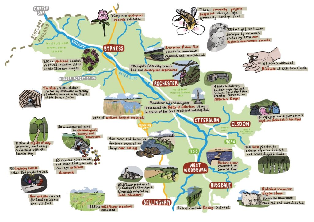
If you would like to read our interim progress report in full, we’ve included the file at the bottom of this page.
We would like to take this opportunity to thank everyone who has supported our project to date. To our fantastic partners, volunteers and supporters both within Redesdale and beyond, thank you so much!
The coronavirus pandemic has since thrown many hurdles our way, but it has also challenged us to look for new ways to reach our audiences, creating exciting opportunities for future development. We look forward to more great things to come!
The Revitalising Redesdale Team
Hi everyone! My name’s Katie, and I’m the new Programme Officer for Revitalising Redesdale. I joined the project earlier this month and would like to introduce myself! I’m really excited to be on board.
My chapter in the north-east started when I relocated to Newcastle upon Tyne in May this year from Leicestershire as soon as restrictions allowed. I must admit, although I’d already visited many times, it was very strange moving to a new city in the middle of lockdown. Luckily, since then I’ve been able to explore the north-east a little. Unsurprisingly, as a massive fan of nature, history and rambling, it didn’t take me long to fall in love with the region, especially once we made our way into Northumberland. From Boulmer to Kielder, I became totally enchanted. And then along came Redesdale…
By the time that I was invited to join the project, I hadn’t ventured as far as Redesdale! When I found out that I’d been appointed, the following weekend my partner and I decided to have an impromptu gander around the valley, stopping for a while at Carter Bar. We were very lucky with the weather, something which I’ve since realised is far from being a guarantee! I was in awe of the valley’s remote beauty and couldn’t wait to get to know the area better.
On our way home, we decided to stop for lunch at the William de Percy Inn in Otterburn. I still regret not choosing one of their famous crêpes (I know, I have no idea why either), but now I have an excellent excuse to return! One thing that I’m sure you’ll find out about me soon enough is that I’m a massive fan of the natural world. I’m a keen birdwatcher, but my love also includes plants and trees (and especially propagating them, much to my partner’s dismay!). To celebrate my new role, we also visited a garden centre on our way back and I finally became the proud owner of a Red Robin tree! It was a little tricky getting it into the car…

After our initial foray into Redesdale, I didn’t have too long to wait before my first week in my new role. I was given the grand tour of Redesdale, this time through the eyes of the project. From the infamous horse skulls at Elsdon to the nineteenth-century reservoir at Catcleugh (and substantially soggier weather up at Carter Bar in comparison to my previous visit!), it was a perfect introduction to the spellbinding tales that Redesdale has to offer. We were also treated to a stunning view at the end of the day, courtesy of the River Rede. If you’ve visited Redesdale, I’m sure you’ll have seen how beautiful the colours are there, whatever the weather (if you haven’t – do go!). It’ll be lovely to see them change as the year trundles on.
My passion for the natural world also extends into the historic past. I’m a landscape historian by trade and completed my PhD in the Centre for English Local History at the University of Leicester a couple of years ago. I am fascinated by our relationship with the natural world, past and present, and in that wonderfully intimate connection between people and place. I spent quite a lot of time thinking and writing about how the fifteenth- and sixteenth-century Leicestershire gentry influenced and were influenced by the world around them, so it’s great to now be firmly based in border reiver territory! I’m also on the board for the British Association for Local History, so I’m super invested in local and regional history more generally.
So what does my role involve exactly? Well, in a nutshell, I’m stepping into the shoes of my brilliant predecessor, Nick Lightfoot. I’ll mostly be desk-based accompanied by spreadsheets and reports, but there’ll be plenty of opportunities for getting better acquainted with Redesdale too! I’ll definitely be making some noise about our Community Heritage Fund so you’ll be hearing more from me about that soon. I’ll also be working with our wonderful team and partners on our projects, so stay tuned!
In the meantime, I’m really looking forward to getting to know everyone, so if you happen to see me out and about in Redesdale with the team, come and say hello!
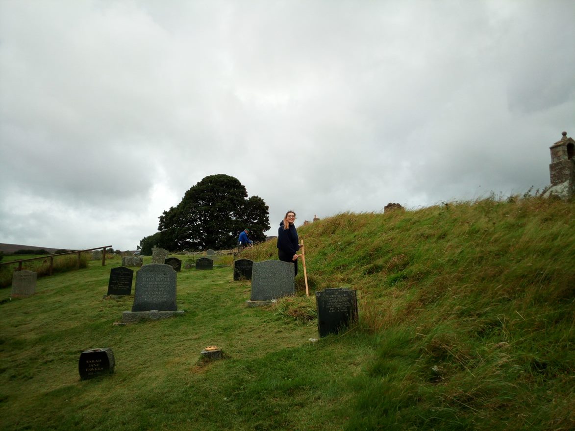
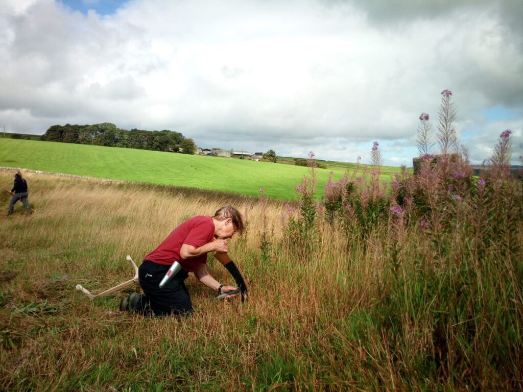
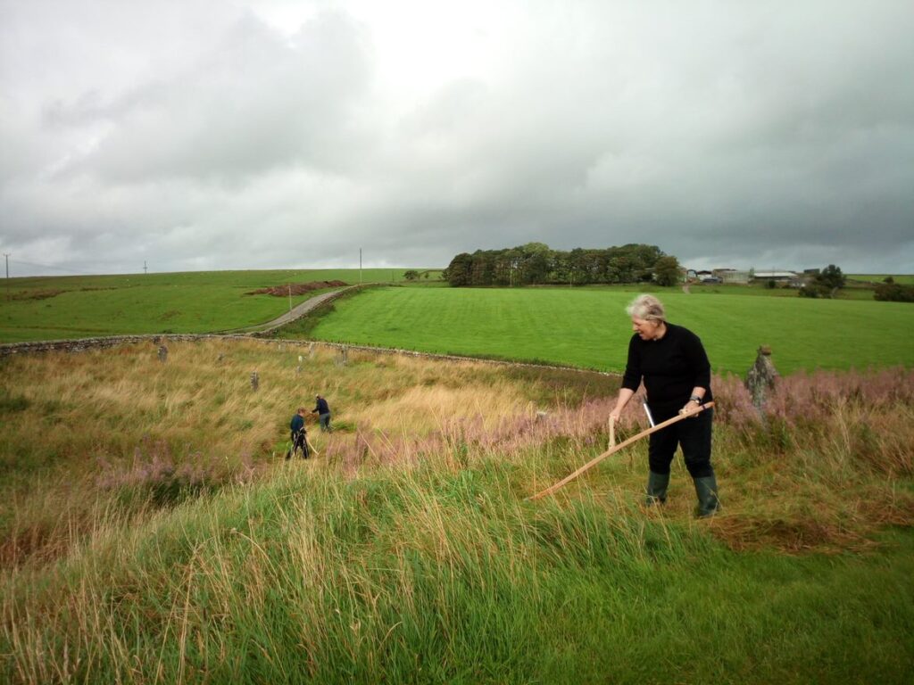
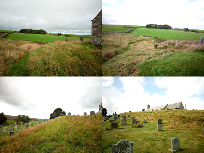
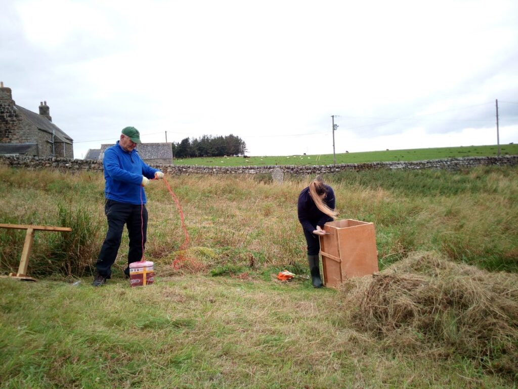
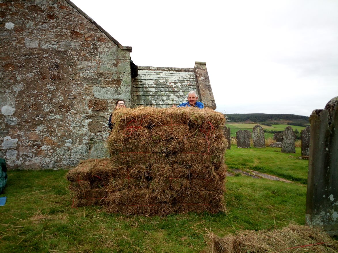
A first experience of a traditional skill by Natasha Hemsley, Revitalising Redesdale Assistant Trainee.
Hello again,
At the beginning of the month, I was fortunate enough to visit the beautiful St. Cuthbert’s Church, Corsenside. I was there with Northumberland Wildlife Trust volunteers to provide reinforcements to a group of local volunteers, continuing their great work in the churchyard over the last couple of years.
We were tasked with scything two sections of grassland within the churchyard. The majority of wildflowers had finished flowering but the scythed wildflower meadow areas and the adjacent unmanaged coarse, tussocky grassland were still poles apart!
The first task of the day was to become familiar with the scythe itself. Having not used one before it was quite daunting knowing I’d be wielding a large blade around at my feet. I hoped that I’d managed to tighten it correctly so it didn’t swing off and do some harm! (Editor: I don’t think this actually happens, but if not tightened enough the blade can easily get knocked out of correct alignment and need adjusting again!) Following steps set out by a scythe training manual, helped by the best efforts of someone who had done it before, we managed to attach the relevant parts of our scythes and correct the position of the blade for accuracy of cut. It was then time to practice with our newly assembled tools.
Others took to it straight away, however I seemed to lack the technique of a graceful swing and felt as though I was instead hacking my way through the grass, using brute force rather than skill. I chose to believe the others when they insisted that skill comes later, with more practice. Either that or it’s their cunning plan to get me to help again next year…
I’m told we had it much easier than in previous years, since this is the third year of the project, so the meadow areas have had their annual cut twice before. Despite this, the next day I felt aches in muscles that I didn’t know I had and clearly hadn’t used before! However, being able to see easily the areas cut and the difference this management is making to the diversity of the grassland made it well worth the effort.
By far my favourite part of the whole process came later: The cut grass is left to dry, turned, the odd nettle/thistle/rosebay willowherb is removed to compost, left to dry again, turned and so on until it is time to bale the hay. A simple process, but therapeutic and rather fun, playing with the purpose built hand baler, alongside a smaller working prototype making tiny bales. Together we created a tower of hay bales ready for local distribution.
If you would like to lend a hand alongside local volunteers next year, keep an eye out for updates on our website and Facebook page.
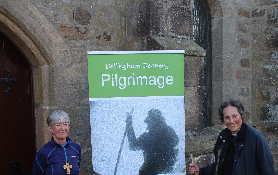
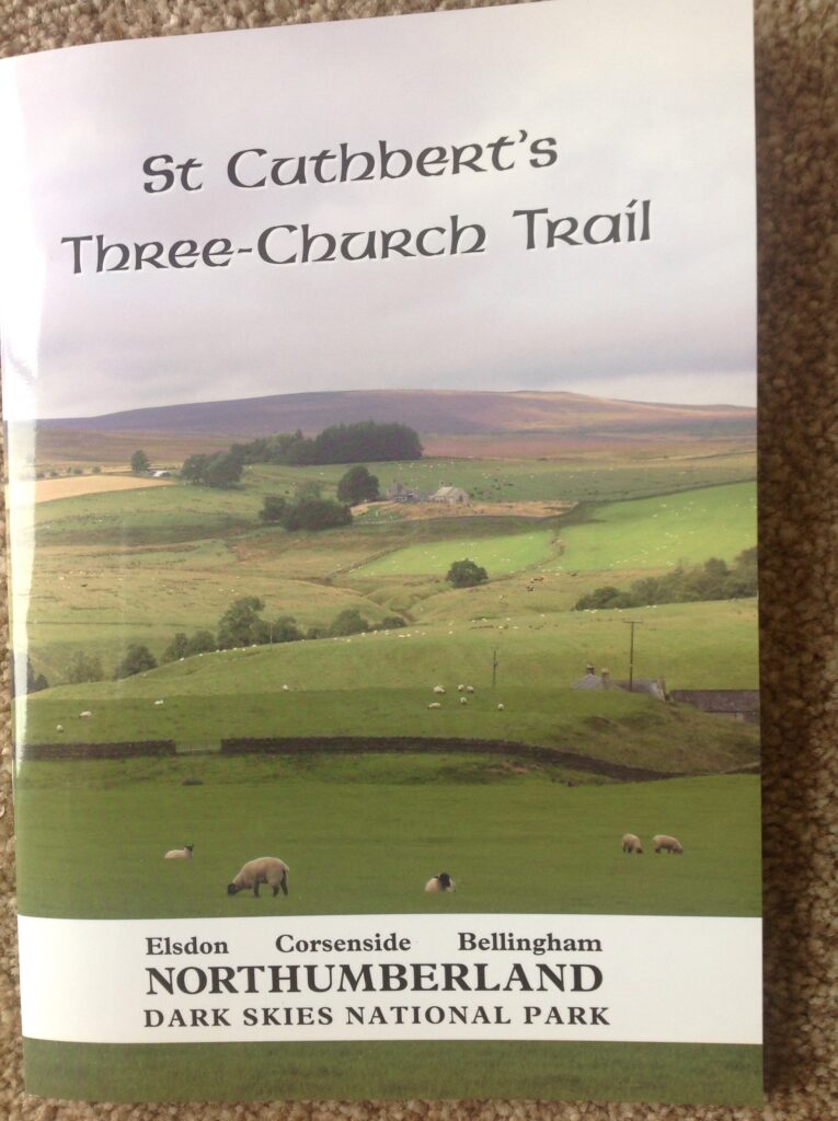
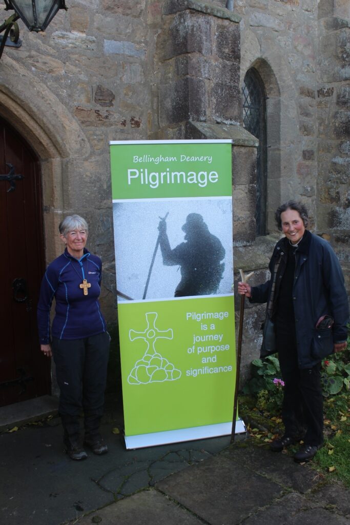
5th September 2020 – Marie Ness, Project Manager St. Cuthbert’s Three-Church Trail
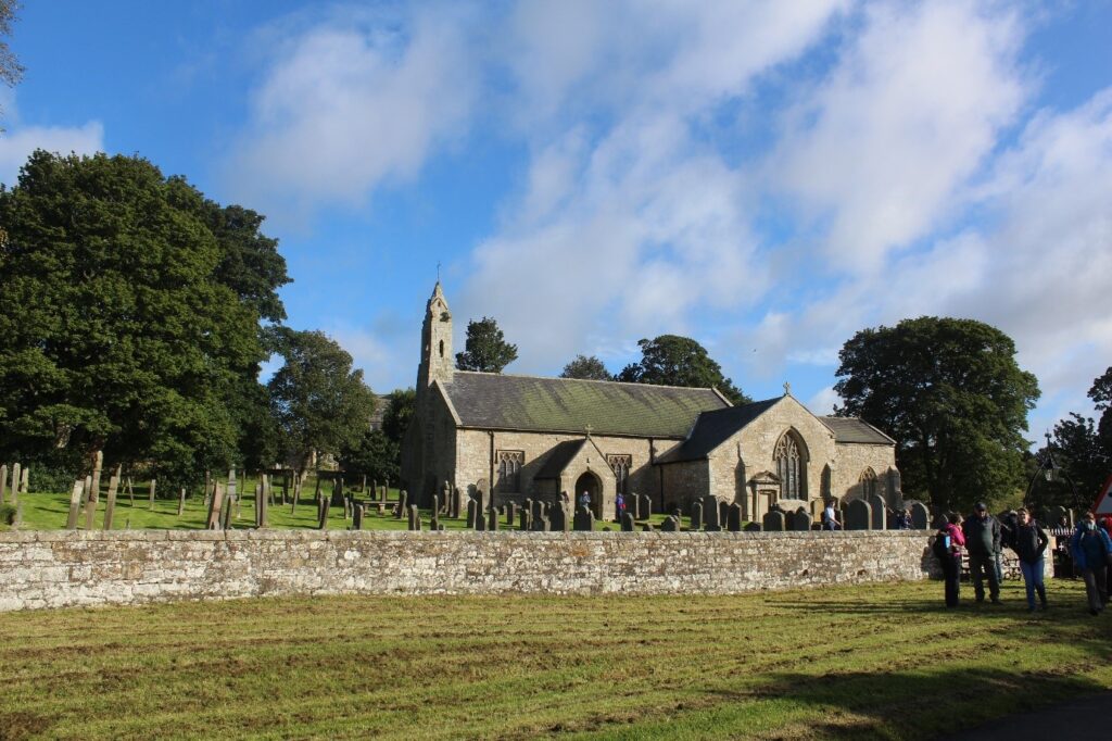
Bishop Christine was one of the many Pilgrims that set out from St. Cuthbert’s Elsdon on Saturday 5th September to bless the official launch of the St. Cuthbert’s Three-Church Trail from Elsdon, via St. Cuthbert’s Corsenside and then on to Cuddy’s Well and St. Cuthbert’s Bellingham.
As we set off across the village green and up into the hills we stopped to remind each other of Cuthbert “stories”. We recalled how Cuthbert himself had seen a light in the sky and the next day had learned Saint Aidan had died, and so prompted Cuthbert followed his vocation and joined the monastic community at Melrose.
The St. Cuthbert’s Three-Church Trail Group have worked with Revitalising Redesdale to provide waymarkers along the Trail and improve the crossing at Smoutel Ford, which is passable when the River Rede is low. Unfortunately after a wet August we were not able to cross the Ford. However in blessing the newly installed Ford Bishop Christine also reminded us that in life just as on our pilgrimage walk today we often are faced with barriers that we have to overcome and find ways around. In the distance we could see St. Cuthbert’s Corsenside on the top of the hill, we were rewarded in our detour with deep conversations with new and old friends, more Cuthbert stories, wandering paths and rushing streams. Up the hill we walked once more on the steady climb up to the simple peace and tranquility of St. Cuthbert’s Corsenside.
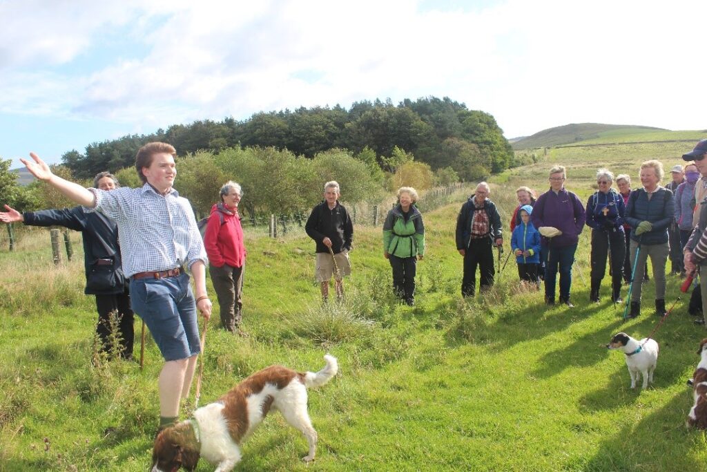
Fortified by our picnic lunch in West Woodburn, where many friends joined us, some to continue with us on our journey, others to encourage and support friends on their way. Undeterred by a sharp shower we continued across country and on a bridge where the River Rede meets the North Tyne stopped for rest and to listen to the story of Cuthbert and the Otters who lovingly warmed Cuthbert’s feet after he had sought solitude in the sea.
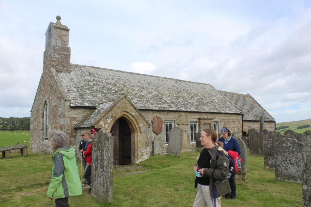
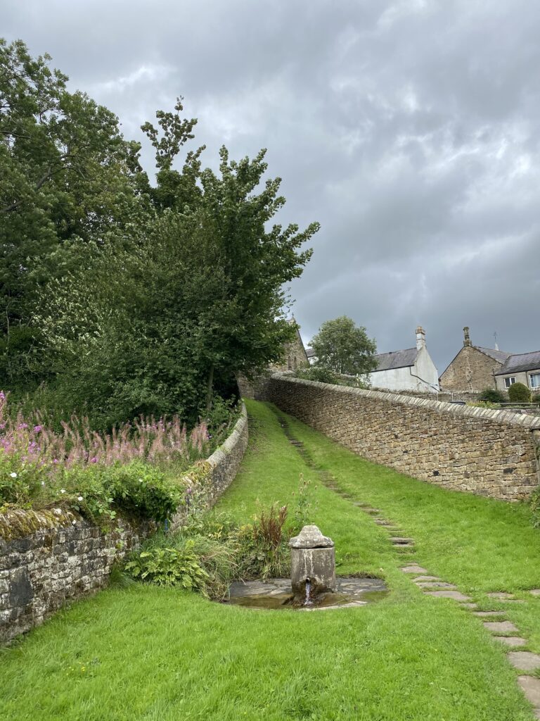
Eventually we emerged from the Riverside path to arrive at “Cuddy’s” Well Bellingham, a natural Spring said to have never dried up since St. Cuthbert blessed it, and linked to miraculous cures over the centuries. Most of the pilgrims certainly partook of the metallic tasting water to quench their thirst. After a blessing at the Well we ascended the steps to St. Cuthbert’s Bellingham where we had prayers including special thanks for Revd. Dr Susan Ramsaran who has played a major part in the Trail’s creation and has written the St. Cuthbert’s Three-Church Trail booklet and retires after St. Cuthbert’s Festival Weekend. Bishop Christine expressed her strong support for the installation of steps and a pathway to connect Cuddy’s Well and St. Cuthbert’s Church Bellingham, emphasising that it will encourage more visitors and importantly further the development of spiritual pilgrimage in Northumberland.
The three St. Cuthbert churches are also working together on the Rural Churches for Everyone project. The Trail and the installation of steps at St. Cuthbert’s Bellingham is very much part of the sustainable future for these churches, communities and our St. Cuthbert’s Heritage. If you would like a copy of the St. Cuthbert’s Three-Church Trail booklet written by Revd. Dr Susan Ramsaran please e-mail Marie Ness marie@training4business.org If you would like to make a donation to the further development of the St. Cuthbert’s Three-Church Trail you can donate via the Diocese Donate page https://www.give.net/3churchtrail/oneoff
Article and photos:
Marie Ness, Project Manager St. Cuthbert’s Three-Church Trail
Jill Swaile, Churchwarden St. Peter’s Falstone
It’s been a long lockdown…..
Well, it’s been a long time since our last newsletter. A global pandemic got in the way of our planned activities! The team have continued to work from home, but sadly a lot of our planned delivery has been affected. Since July we have been slowly re-starting volunteer activities and we are planning how to carefully increase this over the coming months in a safe way.
So here’s a round-up of what we have managed to do over the last month, and what we hope to be doing next!
Welcome to Natasha!
We welcomed our new Trainee Assistant, Natasha, at the beginning of August. Natasha will be supporting various aspects of project delivery, working part-time as part of the Redesdale team and part-time for Northumberland Wildlife Trust at their new reserve, Benshaw Moor. Find out more on Natasha and what she has been up to so far on the link below.
Nick jumps ship!
We are very sad to announce that Nick Lightfoot, Programme Officer, is leaving us at the beginning of September to take up a new, more senior role within Natural England. He’ll be sorely missed, but we wish him all the best in his new role.
We are currently recruiting for Nick’s replacement, find out more about the Programme Officer role and application here.
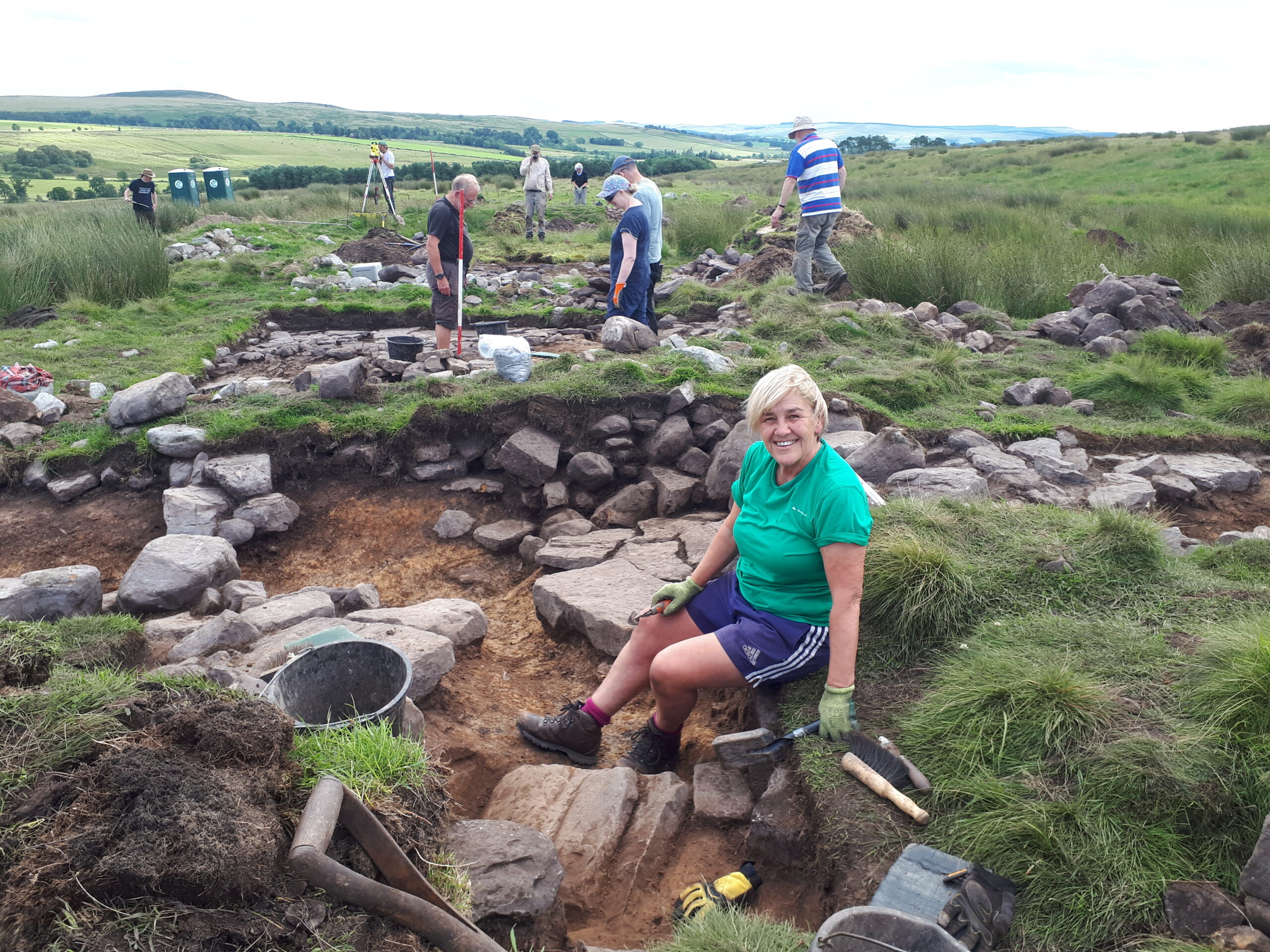
Revisiting Rattenraw
One of the first volunteer activities we were able to carry out post-lockdown was the second phase of our excavation of an Iron Age settlement at Rattenraw, where we made further exciting discoveries.
Excavation with Operation Nightingale
We’re also going to be running a second dig, in partnership with Breaking Ground Heritage and Operation Nightingale, an initiative for injured and sick veterans and service personnel. We’ll be looking at probable prehistoric features on the Otterburn Training Area identified during our Lidar survey.
The Gun Inn Re-Opens!
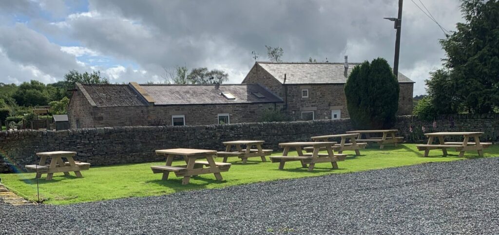
After a hugely successful fundraising campaign, the Ridsdale Community Group re-opened The Gun Inn at Ridsdale on Thursday 27th, with full restaurant facilities from Friday 28th August. You will now find a brand new set of picnic benches in the pub garden to enjoy a drink with a view, which the Group applied for funding for through our Community Heritage Fund.
St. Cuthbert’s Three Church Trail
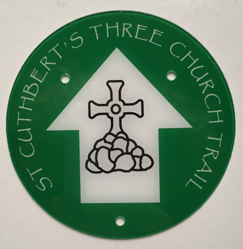
We are working with St. Cuthbert’s Three Church Trail Group to create a new marked trail through Redesdale. The route takes walkers and pilgrims alike to the three local St. Cuthbert’s Churches, from Elsdon to Corsenside and Bellingham. The Group was awarded funding from our Community Heritage Fund to produce a guide booklet for the route and we have recently installed new waymarkers to aid navigation.
St. Cuthbert’s Weekend 4-6th September 2020
Join the festivities for this year’s St. Cuthbert’s Festival!
Friday 4 September 7:30 pm by Zoom – Join John Grundy and Peter Ryder in conversation about St Cuthbert’s Bellingham, followed by a Q&A. E-mail Elaine Ryder for joining details: revelaine212@gmail.com
Saturday 5 September 9:00 am– Walk the St Cuthbert’s Three-Church Trail with Bishop Christine. Bring your own picnic or contact Revd Dr Susan Ramsaran to book lunch: smramsaran@aol.com
Sunday 6 September – Special services for St. Cuthbert’s weekend at St Cuthbert’s Bellingham (9.30am) and St Cuthbert’s Elsdon (6:00pm). E-mail Elaine Ryder for joining details: revelaine212@gmail.com
We are recruiting! Do you want to join a dynamic team and help deliver a landscape scale programme of innovative projects celebrating Redesdale’s natural and human heritage? Find out more below…
On behalf of the Revitalising Redesdale Landscape Partnership, Natural England would like to appoint a Programme Officer to work as part of the Revitalising Redesdale team to support the delivery of a five year National Lottery Heritage Fund (NLHF) funded programme of 12 inter-related projects. The Revitalising Redesdale Landscape Partnership Scheme began implementation in January 2018 and will end in December 2022. The four person team are delivering a £2.8 million programme to celebrate Redesdale’s rich cultural heritage and to protect and enhance the area’s landscape, archaeology and wildlife.
The Programme Officer will have particular responsibility for supporting administration, managing and maintaining the financial records of the programme and managing the small grants Community Heritage Fund. They will work with partners and Revitalising Redesdale team to help deliver rights of way improvements, and record project activity progress within Redesdale.
For full job specification and application details see: https://networkrecruitment.tal.net/vx/appcentre-7/brand-4/candidate/so/pm/1/pl/8/opp/2879-2879-Programme-Officer-Revitalising-Redesdale-Landscape-Partnership/en-GB
Deadline for applications: 4th September at 23:55 hours
This week, we have the pleasure of introducing our newest team member, Natasha Hemsley, the Revitalising Redesdale Trainee Assistant. We are thrilled to have you aboard! Without further ado, over to you, Natasha…
Who am I?
Name: Natasha Hemsley
Background:
- Geography Undergraduate Degree at Newcastle University
- Environmental Resource Assessment Master’s Degree at Newcastle University, focusing on biodiversity conservation, soil analysis and habitat surveying.
- Trainee placement at Yorkshire Wildlife Trust with the conservation team.
Interests: One of my favourite parts of working in conservation is public engagement on volunteer task days, getting to know local people and exchanging knowledge and heritage of the local area. The physical work is enjoyable too, weather permitting!
Hobbies: In my free time I like to explore new places with friends or alone. Getting out and about has been so important to me during lockdown. I’d like these trips to continue and perhaps go further afield as time allows.
What I’ve been up to…
As the newest member of the Revitalising Redesdale team I’ve had an enjoyable, yet busy, first week getting to know Redesdale a little better. This week I have delved into the worlds of history and archaeology at Rattenraw Farm and Bremenium Roman fort, habitat management at Steng Moss and Benshaw Moor, and also river management along the Rede, a particularly important feature within the Redesdale Valley as I’m sure you will agree!
I joined a wonderful mix of enthusiastic volunteers and extremely knowledgeable members of local archaeological groups on one of their final days of excavation on this Iron Age site. For some, these 10 days at Rattenraw Farm have been the first time they’ve been out in a very long time and this project represents months of hard work and perseverance to bring outdoor volunteering back onto site, working safely.
As my first ever archaeological dig it was great to get stuck in with the team and learn some trench etiquette, like keeping your feet out of the trench! From photographs of the site it was difficult for me to imagine the structure of the Iron Age settlement and envisage how life could have looked for the people that lived here.
Getting shown around in the flesh changed all that. For a complete novice like me, being able to see the change in the landscape between inside the ramparts and beyond the outer ditch was all I needed to start speculating what certain excavated features were and why they were there.
Impressive finds like the 100+ coloured glass beads found at the site, during this and a previous excavation, are suggested by experts to have Egyptian origins, pointing to a rather more sophisticated life here than I had previously imagined for this Iron Age farmstead.
This Roman Fort at High Rochester unfortunately could easily be missed within the landscape if you weren’t paying close enough attention. This important piece of history was in great need of repair and so the project here aimed to protect the site from further degradation rather than rebuild the fort in its entirety.
Despite the site still being very much in ruin, taking the pathway around the site gave me a feel of how defensive the outer walls would have been when inhabited by Roman troops.
Sections of the walls and features like the western gateway have been repaired and look like they had not been touched at all, concealing the huge effort and hours of work put into the project here. This means that future generations can enjoy this site as it is now rather than see it disappear due to deterioration and collapse.
This treat for the eye captures stunning views in all directions and is a lovely spot to take a minute to relax within the landscape, as I found out on my first visit to the structure.
Standing at 457m above sea level ‘The Nick’ sits at the highest point of Kielder’s Forest Drive and while it forms the very Western edge of the Redesdale valley, it should be celebrated as a great example of project partnerships within the North East.
Whitelee Moor National Nature Reserve
What a reserve! Entering Whitelee first from the forest track entrance off the A68 and then from higher ground at Carter Bar, a stone’s throw from Scotland, I really got a feel of how vast the site actually is (over 1500ha).
The active blanket bog and heather moorland here pique my interest as numerous hours could be whiled away surveying the site across its diverse range of habitats. Despite the mist on this particular day, the views were stunning and I’m sure they’d have been even better if we’d have carried on up to the highest point!
Views of Catcleugh Reservoir from Whitelee at Carter Bar. Photo credit: Natasha Hemsley. 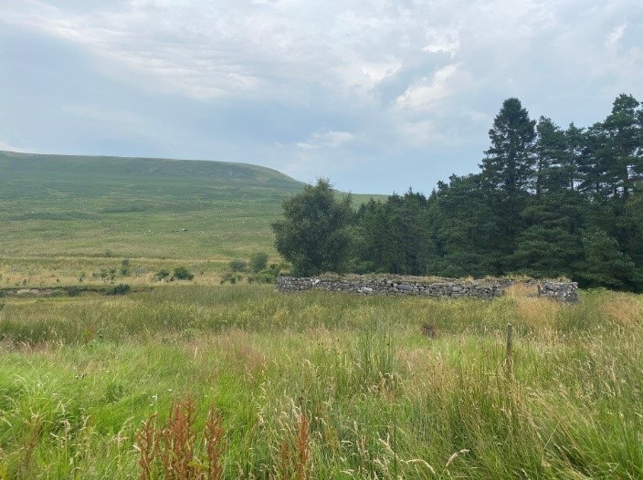
A sheepfold near the gated forest track entrance to Whitelee Moor Nature Reserve off the A68. Photo credit: Natasha Hemsley.
Newcastle University’s Go Volunteer Project at Rupert’s Wood
One part of Redesdale needed no introduction on my tour of the valley…Rupert’s Wood! Across the four years I spent as a student at Newcastle, almost every half term and summer holiday I accompanied excited young people to the wood for camping fun, team building, outdoor games, fire lighting, campfire cooking and telling stories by the fire while roasting marshmallows before bed.
While some of those young people are now adults, I’m thrilled to see the project is still such a success and I am incredibly fortunate to be able to come full circle from a student, volunteering in the hope of improving her CV, to working in my chosen industry and being able to give back to the project that helped me get here.

This week, 13-19 July, is Bees’ Needs Week; an annual event where government, charities, businesses, conservation groups and academic institutions work together to raise awareness of bees and other pollinators. Find out more about the event through the Bumblebee Conservation Trust website.
If you don’t already find bees fascinating, let me outline five reasons why you should have huge respect for these busy little critters:
- The UK is home to more than 270 species of bee but only one produces honey, the Honey Bee: Apis Mellifera.
- We would be very hungry without them. The Department for Environment, Food, and Agriculture estimates that bees contribute more than £500 million a year to UK agriculture, through improving crop quality and quantity.
- The honey bee has 5 eyes, 3 on the top of its head and 2 on the side. That said, their eyesight is pretty poor and they are known to crash land frequently…
- It takes far more effort than you might think to produce one jar of honey. 12 bees will only produce a teaspoon of honey in their entire lives. For every 1lb jar of honey, the bees would have flown 55,000 miles or 2.2 times around the world!
- The drones are male whose sole purpose is to mate with a queen. They only mate once in their short lives as the process kills them! During copulation their sexual organ gets ripped off and they fall to the ground and die from the injury.
Why do we need bees?
Insect pollinators are essential for much of our food, for our environment and for biodiversity. They are essential for seed production by wild plants as well as flowers, vegetables and fruit grown on farms and in our gardens. Pollinators support healthy (and beautiful!) ecosystems, particularly by helping plants to produce fruits and seeds which birds and other animals rely on.
Bees are, perhaps, the most charismatic and recognised pollinators but there are tons of others! Pollinating insects include honey bees, bumblebees, solitary bees, wasps, hoverflies and other flies, butterflies, moths and beetles.
Why do bees need our help?
Globally, most pollinating insects have experienced declines since the 1980s. Unfortunately, the picture in the UK matches this worrying pattern. A recent study showed that “every square kilometre in the UK has lost an average of 11 species of bee and hoverfly, between 1980 and 2013” (BBC) and the “the number of widespread butterfly species fell by 58% on farmed land in England between 2000 and 2009” (The Guardian). Intensive agriculture, urbanization and urban spread, and climate change all contribute to these declines.
That these declines are driven by so many factors tied to our daily lives is both bad news and good news. There is no one solution but we can all help, even in very small ways! That is the motivation behind DEFRA’s Bees’ Needs Week, to highlight the plight of our pollinating friends and what we can all do to give them a helping hand.
For a start, here are five simple actions you can take to help bees and other pollinators:
There are loads more resources and suggestions for how you can get involved on the Bumblebee Conservation Trust website, as well as specific information sheets for farmers, gardeners, and land managers of every type.
Revitalising Redesdale’s Re-flowering Redesdale project is working with farmers, land-owners and local communities to restore and enhance the floral diversity of Redesdale, creating a network for pollinators. A great example of this is at St Cuthbert’s Churchyard, Corsenside, where local community members have established a scything group to manage the churchyard for wildflowers, using the traditional method of scything.
Our Rediscovering Natural Redesdale project aims to help residents and visitors to Redesdale identify and record the wildlife around them. We are working with the Environmental Records and Information Centre North East to boost the recording of pollinators, as well as all wildlife, because we cannot protect what we don’t know is there!
We are also working with the Redesdale Beekeepers Group to fund their project to establish a conservation apiary near Byrness. This will be a haven for the native honey bee, apis mellifera mellifera, which was once thought extinct.
If you are interested in getting involved with either of these projects, please get in touch with the Revitalising Redesdale team.
Now that small steps are being taken to relax restrictions on movement and from the 4th July many more businesses will re-open, many of us are starting to think about holidays and longer trips in the outdoors. So, this week’s My Revitalising Redesdale is a bit of expedition inspiration brought to you by Mike Duckett.
Mike works for Go Volunteer!, which is part of Newcastle University Students’ Union, and leads on our fantastic Redesdale Revitalises project but has been furloughed since the end of March. Mike’s cycle tour is a great example of how we can re-start exploring in a conscientious and green way. Over to you, Mike:
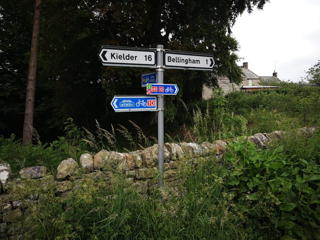
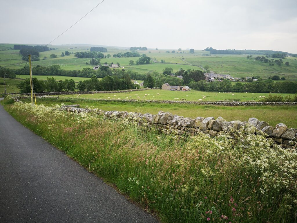
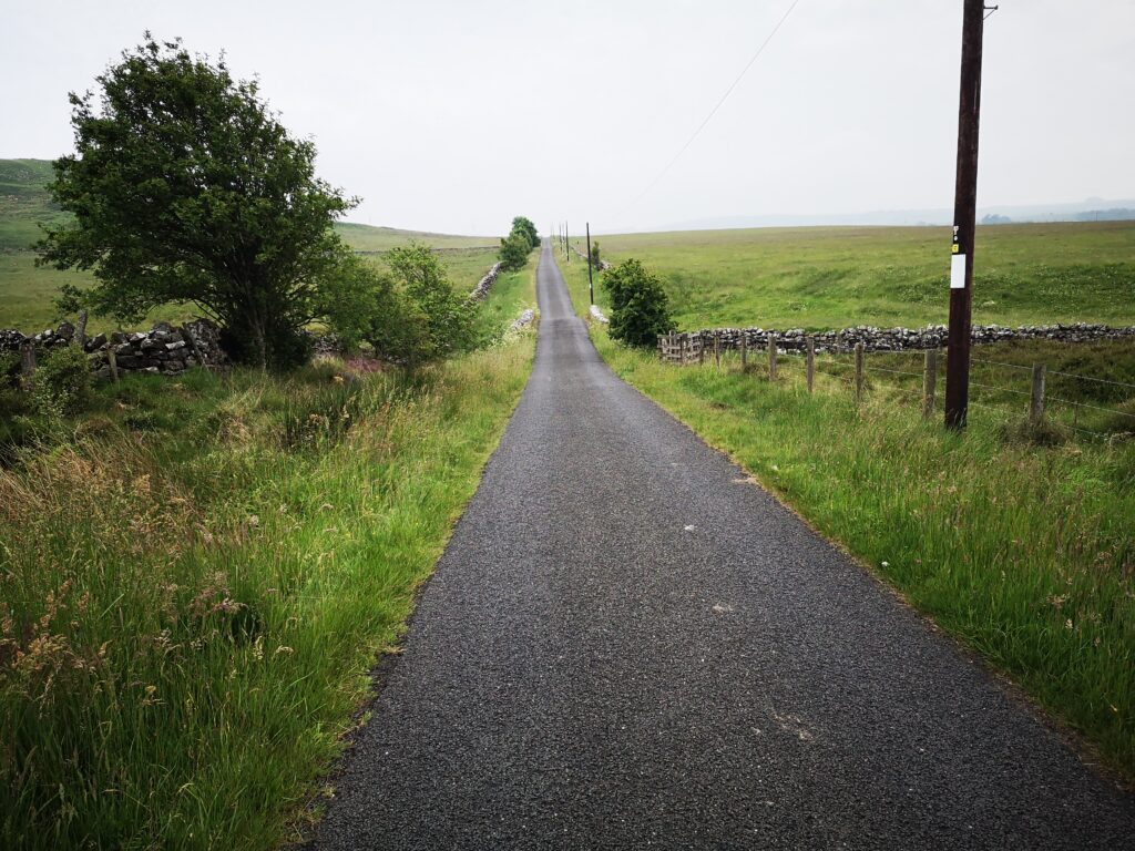
As lockdown eased at the end of June, we decided to cycle from our house in Tynedale to Redesdale. The 68 cycle route goes from Bardon Mill (where we live, on the South Tyne) all the way through Wark Forest and the North Tyne near Stonehaugh to Bellingham, before going over the edge of Corsenside Common and down into Redesdale. In total, from Bardon Mill to Elsdon, it worked out as about 54 kilometres. There were regular hills and some very contrasting roads – from forestry tracks to lovely smooth back-roads. We were on hybrid tyres and they were fine throughout.
Now I should mention that I am not an experienced cyclist. I bought my first ever bike at the start of the covid period when, as a non-car owner, I realised I was really going to struggle to get around – even so far as a post office. My partner Caroline, who shared the journey described below, is a much more competent and practised cyclist. Personally I never even managed my cycling proficiency test at school, because I’d fallen from a roof and was off school at the time with broken things. And then this time, one week into getting my new bike, I went bouncing into a hedge, completely buckling the front wheel and giving myself a 4 coloured bruise that took a full month to ease off.
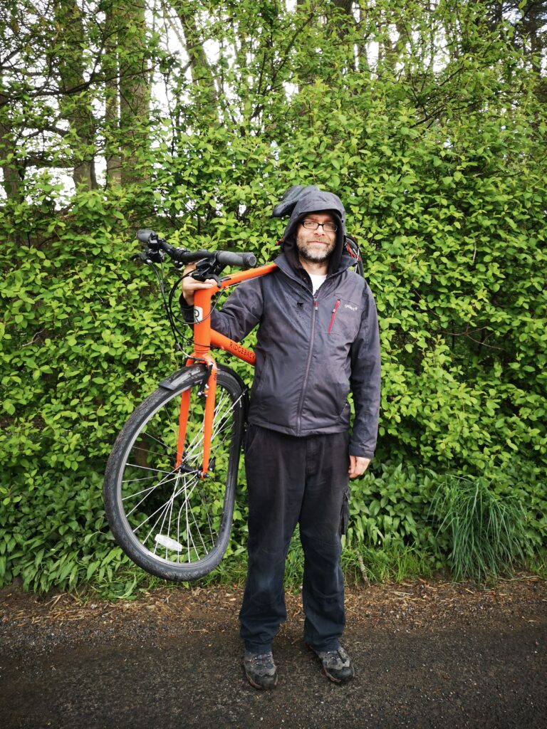
So the 68 route was a sensible choice, because it was mostly off shared roads. While Caroline expects other vehicles to abide by the highway code I generally take a more cautious approach and would often pull the bike off the road for a breather when I saw cars coming. My newbie nerviness however did not affect our speed and our enjoyment of the cycle ride and we can definitely recommend doing it. Get off the train at Bardon Mill and just follow the 68 signs north!
I will skip the early part through Tynedale (although I am writing up this and more trips into Redesdale at www.redesdaling.blogspot.com), and begin at the most relevant part for Redesdale: starting off at a proper functioning town with bakery, pharmacy, George’s great new veg shop and all those extra essentials that you need.
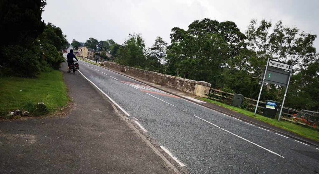
Bellingham
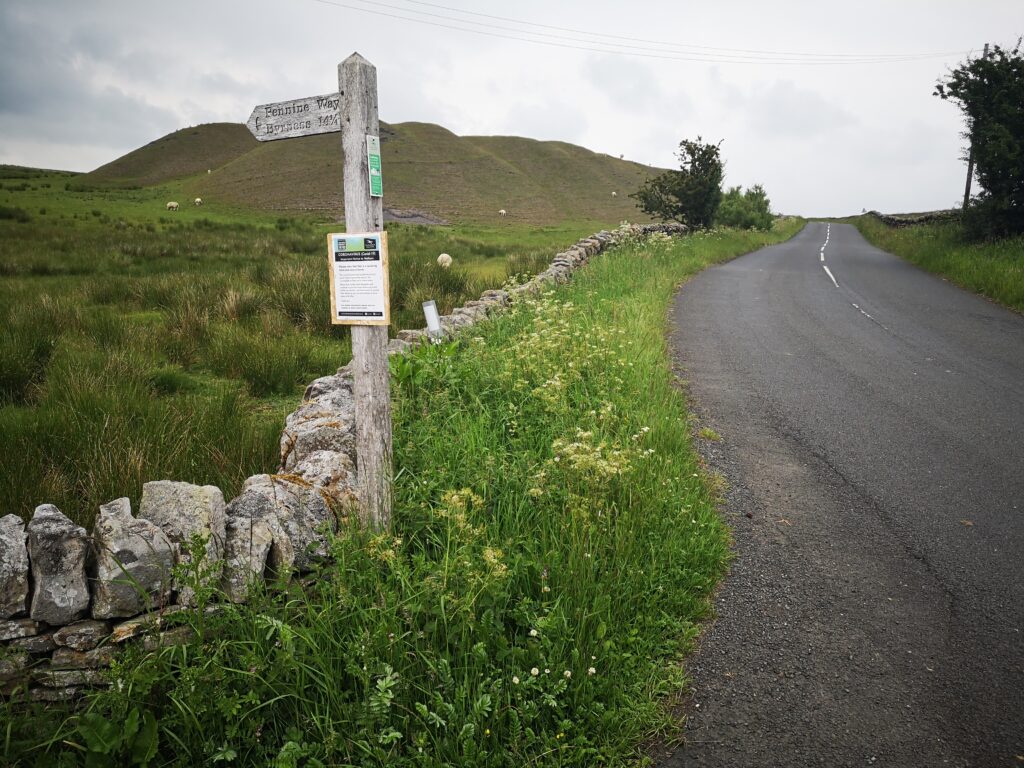
As ‘outsiders’ at this time we weren’t sure where we were welcome to sit (some pub benches had ‘do not sit here’ signs) but we had to stock up on energy before leaving Bellingham. The first climb out of Bellingham is shared not only with the Pennine Way but also with motor traffic on a fairly steep and curvy road that is busy by virtue of being an important link route. When you lose the houses and pavements either side and pass the caravan park, this becomes a section of the cycle route to just plug on with and not relax or drift about. The good news is there is no navigation to do.
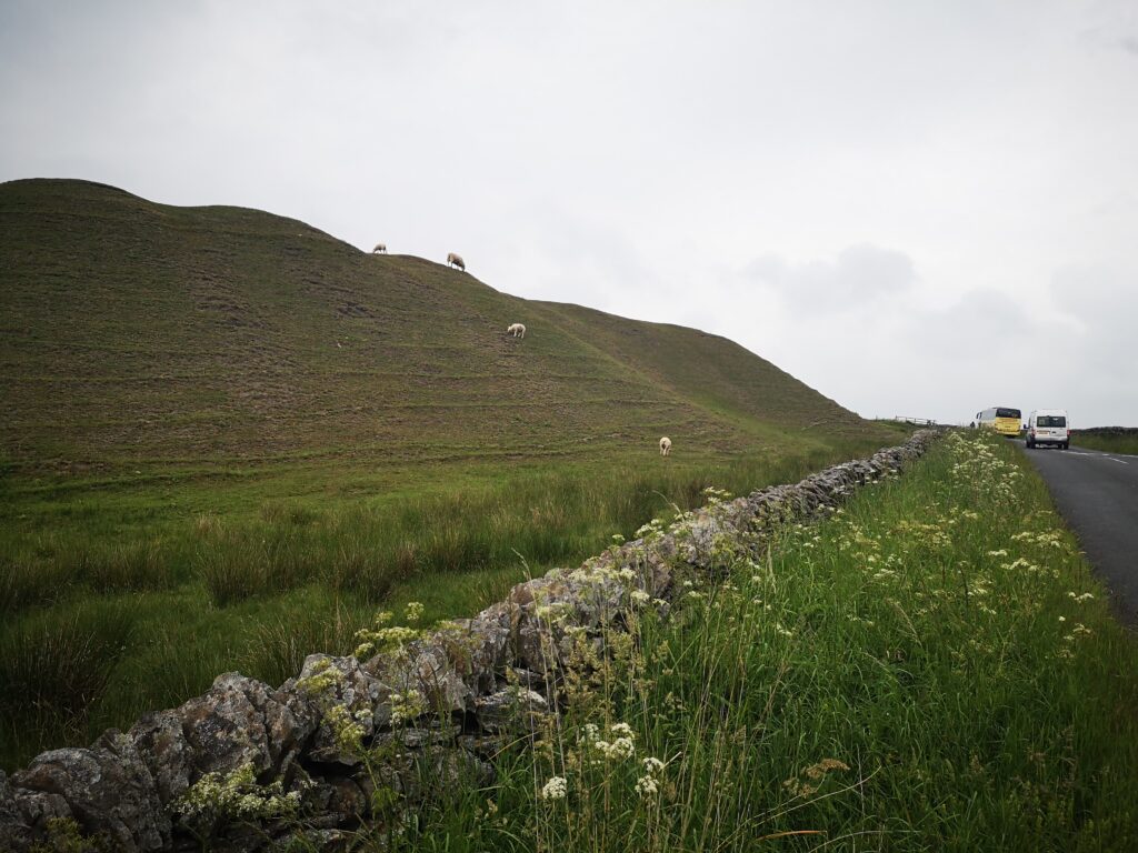
Spoil heaps from the old mining days mark the peak of the hill and give a pleasing platform for grazing sheep.
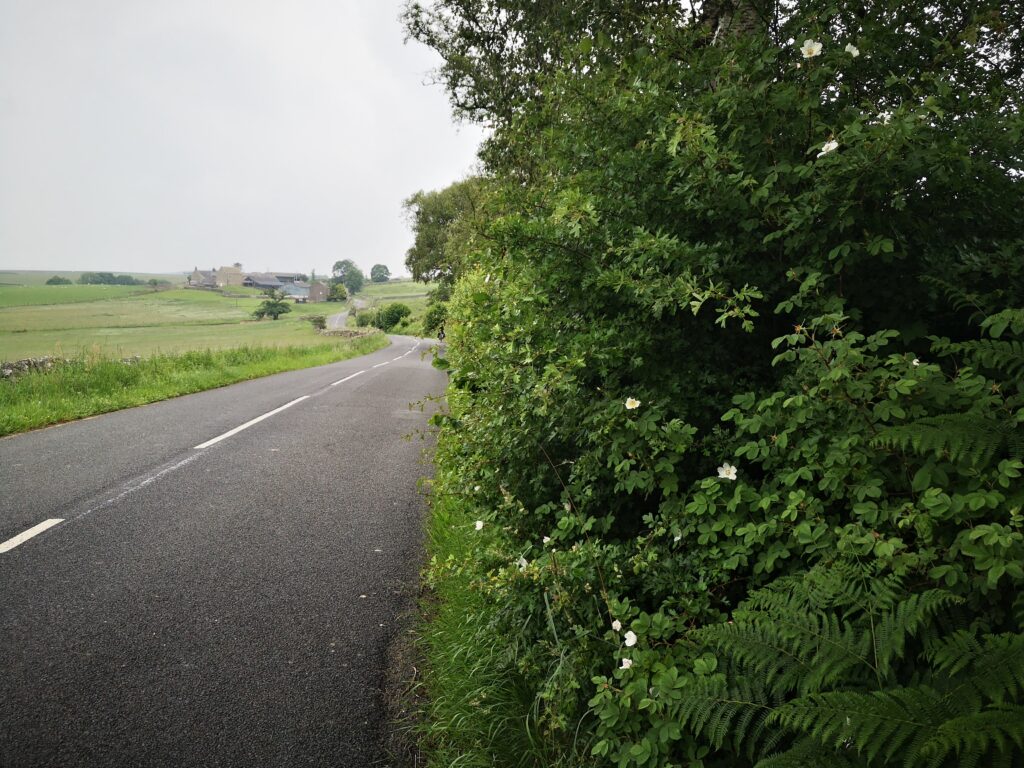
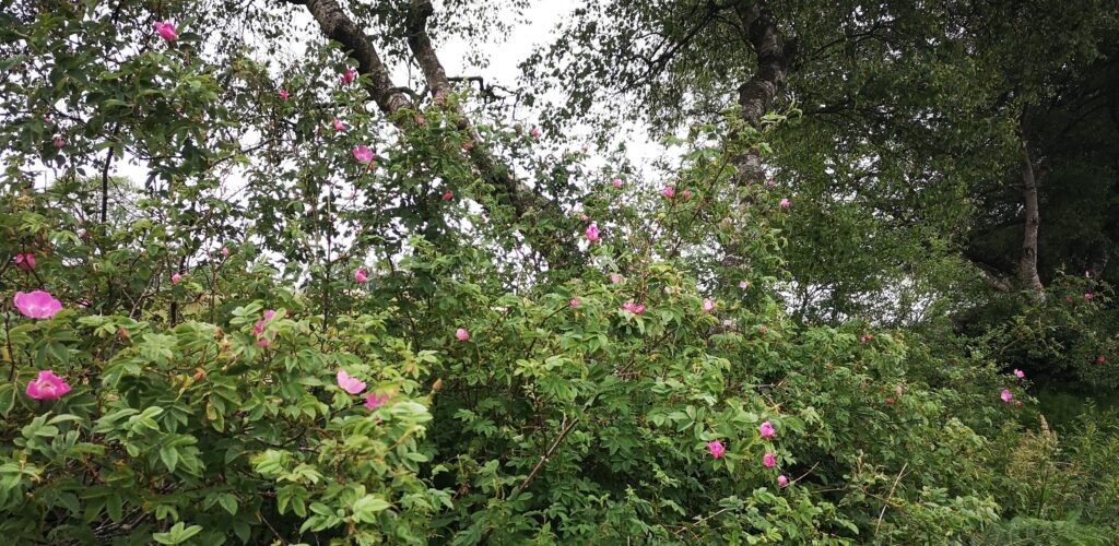
After this short slog up the hill (80 metres gain) you’re on fairly narrow roads with a massively abundant hedge on one side (especially full of pink wild roses) while the first soft views of the watershed to Redesdale appear on your right hand side.
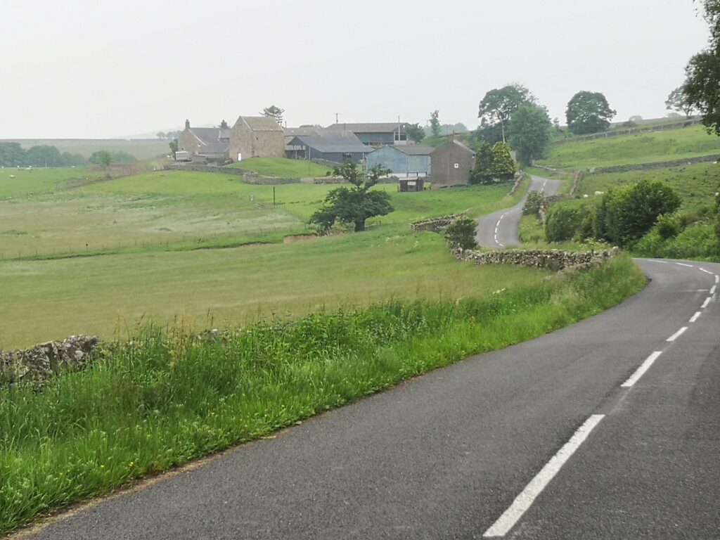
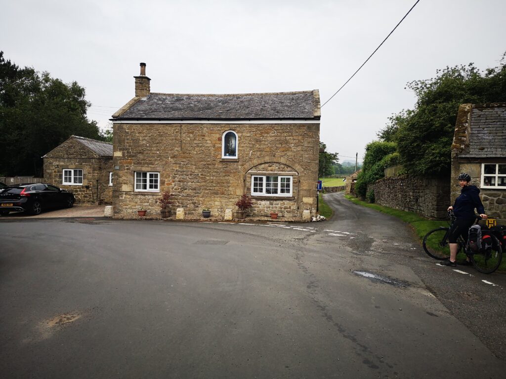
I took advantage of the laybys to take stock of where we were passing. Like everywhere in Tynedale and Redesdale, there is great detail and history in the rural buildings of the area: I’d never before noticed this bastle as part of Hole farm (looking back to where the Rede joins the Upper Tyne).
The road is pretty smooth, suitable for touring bikes as well as our own hybrids. An easy decline takes you down to your first proper stop in Redesdale.
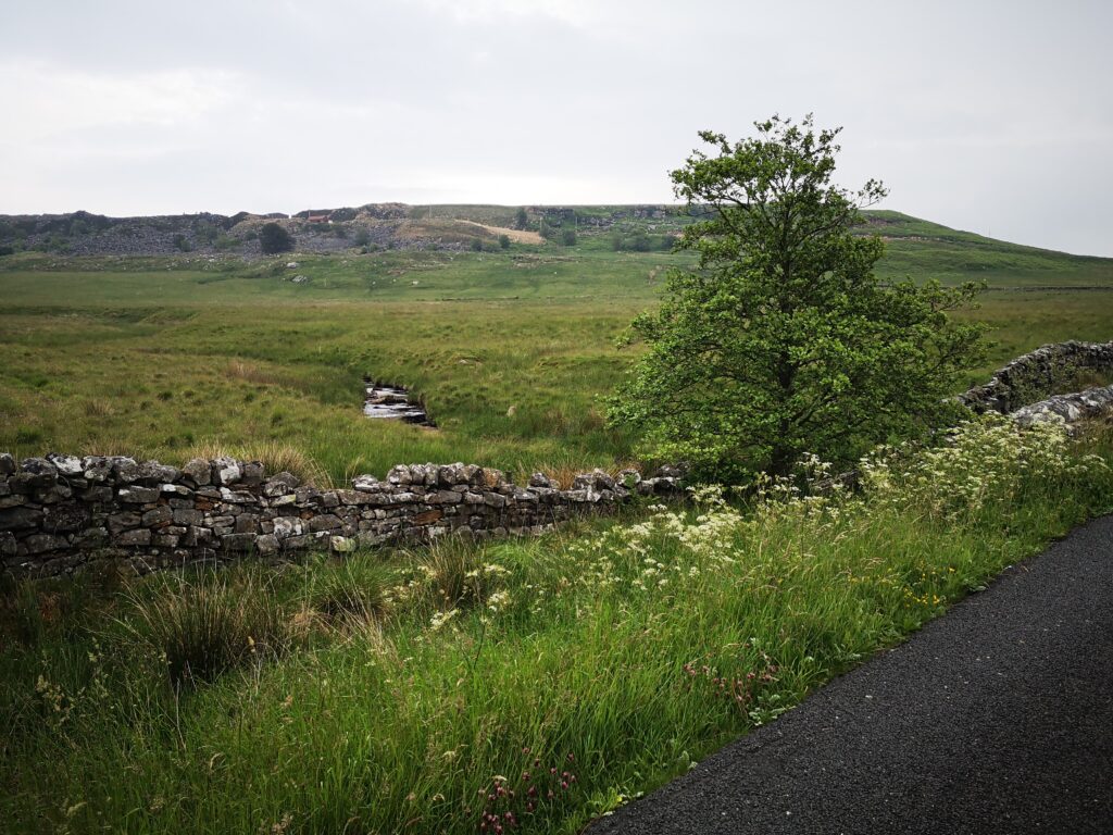
Low Cleughs Bastle, a picturesque ruin with information board, would be a nice short walk (amongst many here), but we didn’t do any extra side trips on this occasion : one thing about cycling is it really puts your legs off walking!
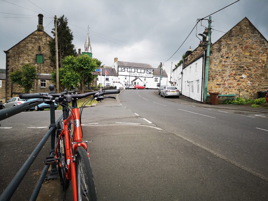
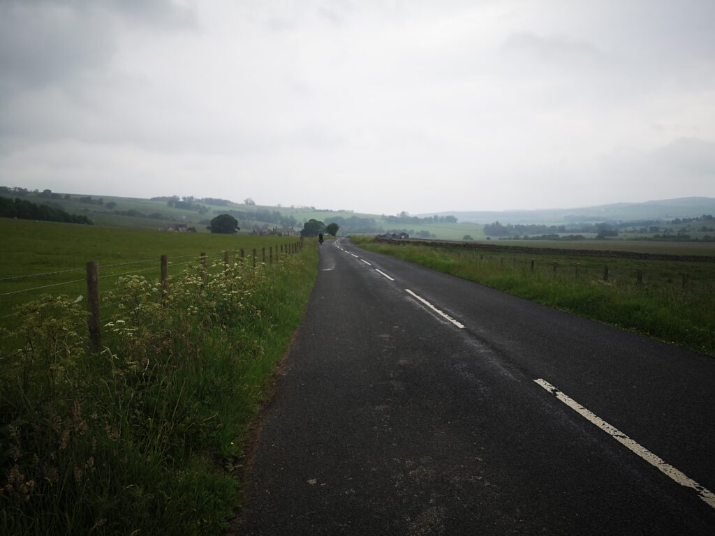
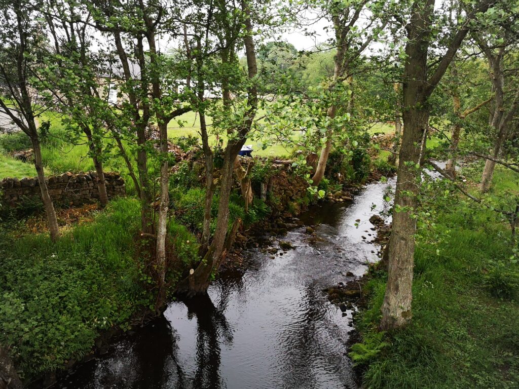
Carrying on to West Woodburn stays easy and slightly downhill, plus it has a better views around you so you feel less of a sense of traffic risk as you gaze around. The exposed rock at Calfclose Crag looks especially good from here.
And then the approach to West Woodburn is surprising, at least for people like me who are used to the A68 route, who have never seen the scenic village row from this direction before.
Ah, if only the Bay Horse had been open and there were no troubles in the world.
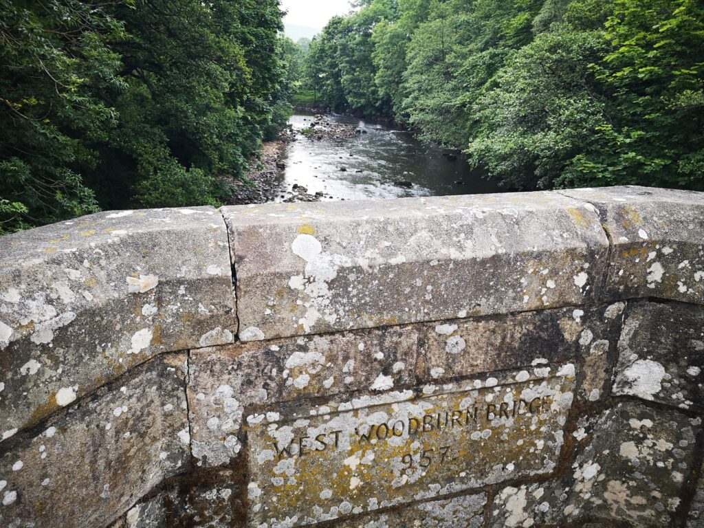
We stopped for a breather, and I’d encourage anyone to get off their bikes here and push right, for the 150 metre section that you’re on the A68. Nice wide pavement and you get to see the Rede as it passes under West Woodburn Bridge.
And then this is the sign left for the road to East Woodburn.
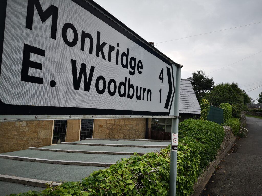
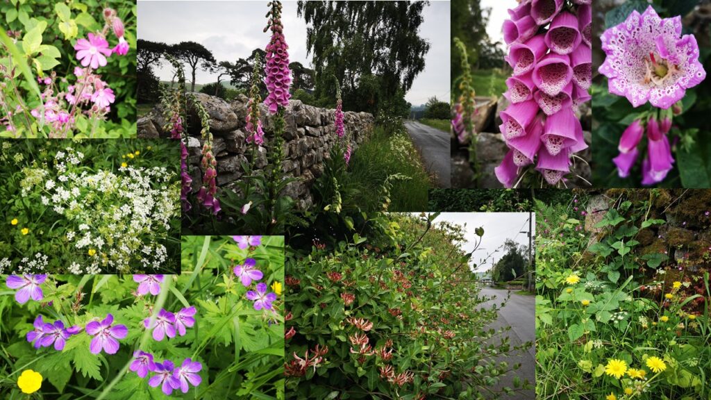
A new bit of Redesdale for me, and it was a really lush quiet road. We passed a walker and a man teaching his daughter to ride a bike. It strikes me as a great, fairly flat, nicely picturesque stretch for anyone who wants to have a little pootle about (very little – the road connecting the Woodburns is only one and a half kilometres long and by car you’d zip between without barely noticing): in June it’s packed full of flowers and a peaceful riverside feeling.
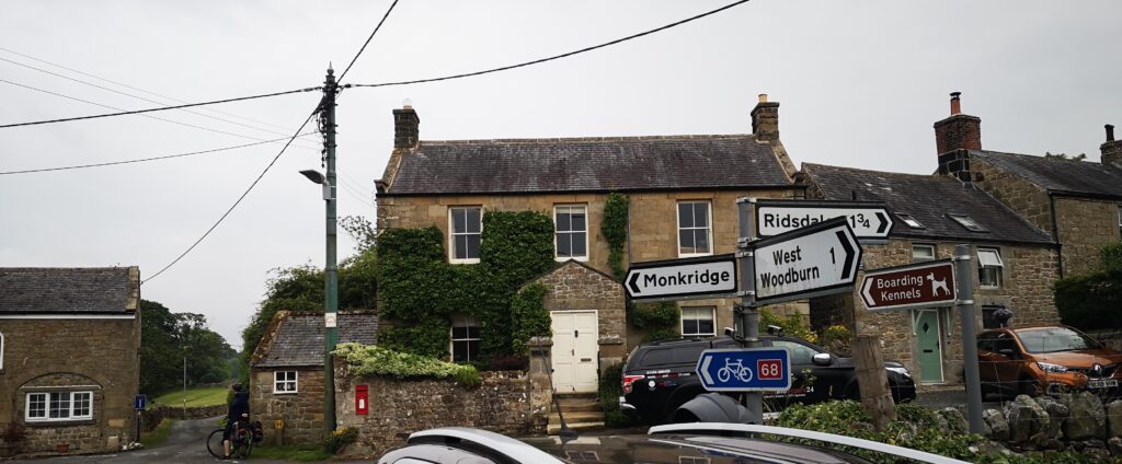
Into the lovely collection of old buildings that is East Woodburn, where the 68 route turns left and crosses the next bridge and then heads uphill.
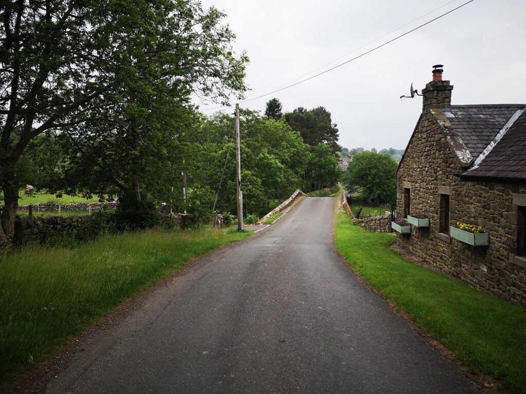
This uphill, coming at the end of a long day’s cycling for us, meant there was nothing for it but to push the bikes up.
The view back down behind us made us think it would be amazing fun coming the other way here on the 68 route: just imagine freewheeling down this way into East Woodburn and then along to the Bay Horse.
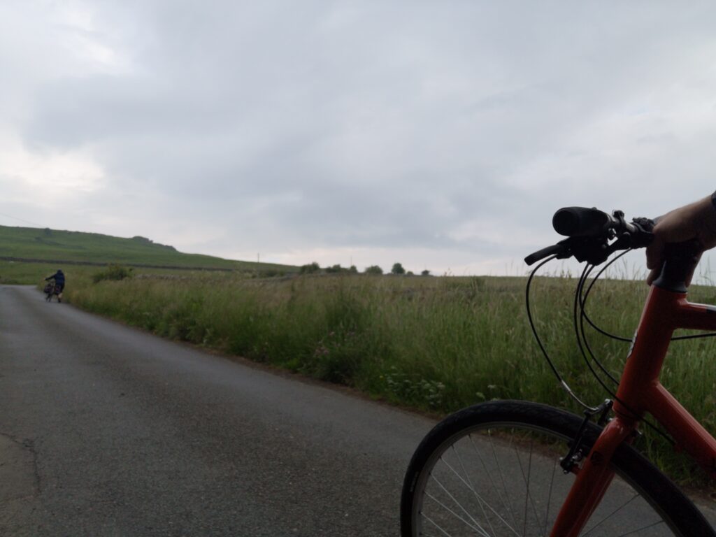
You skirt the bottom of Darney quarry and then for a good long while you’re in peaceful, very rural country on single lane roads.
The sort of country that would be recommended as therapy for those stressed out.
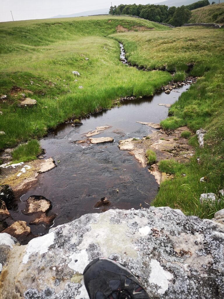
Streams, hidden views, cattle grids. At one point there is even a white gate to open and close to carry on, so you have full permission to go as slow as you like.
One thing to mention is that the signs for the 68 cycle route fizzled out some time after East Woodburn. Not that there are a whole lot of choices to go wrong with, but as you go for 5 km on this lovely pastoral valleyside you get so you’re not quite sure where your delightful, slightly up-and-down route is taking you, the odd bit of reassurance might come in handy!
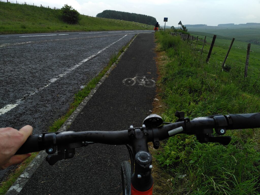
And then it’s the A696 at Monkridge. It’s been a lovely stretch coming down here and I am frankly terrified of this major road. We hadn’t researched in advance so were anticipating having to share with traffic as we headed right and south east a little till the Elsdon turn off at Raylees. Happily, there are people out there much forward-thinking than me and after a layby which is there as you meet the A696 (meaning you do not need to venture on to the A696 at all), there is a continuous cycle path parallel to the main road.
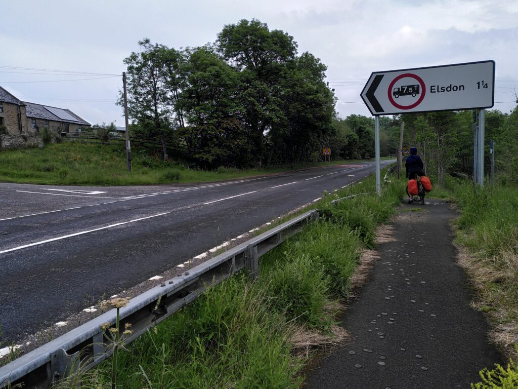
Unclear signage for bikes I thought, and Caroline was about to carry on before I called to her to stop here.
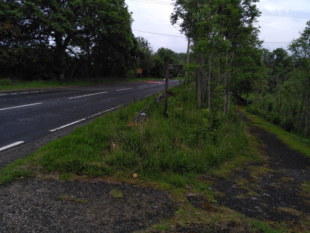
You cross at the roadsign for Elsdon and beware.
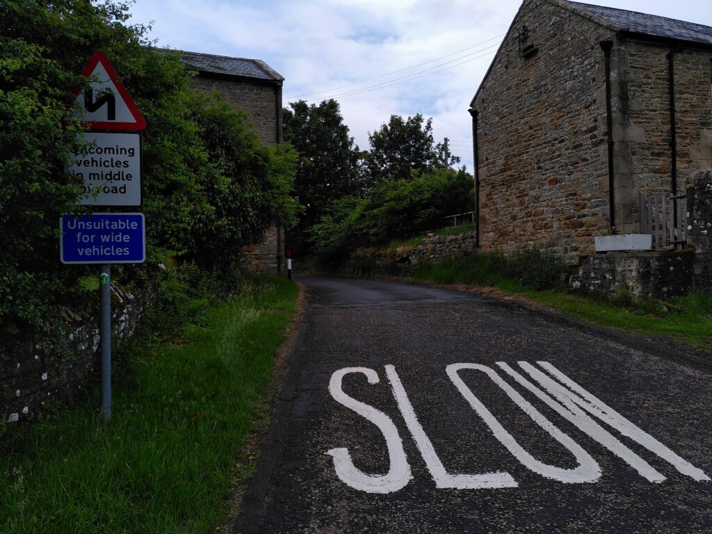
It is natural, if you’re not thinking, to cross over into the wrong lane, where the traffic coming out of Elsdon has a blind passage just before it joins the A696. So a bumbling cyclist could easily find themselves encountering a blindsided vehicle. Incidentally, the cycle signs here are written for the Sandstone way, temporarily equivalent to the 68.
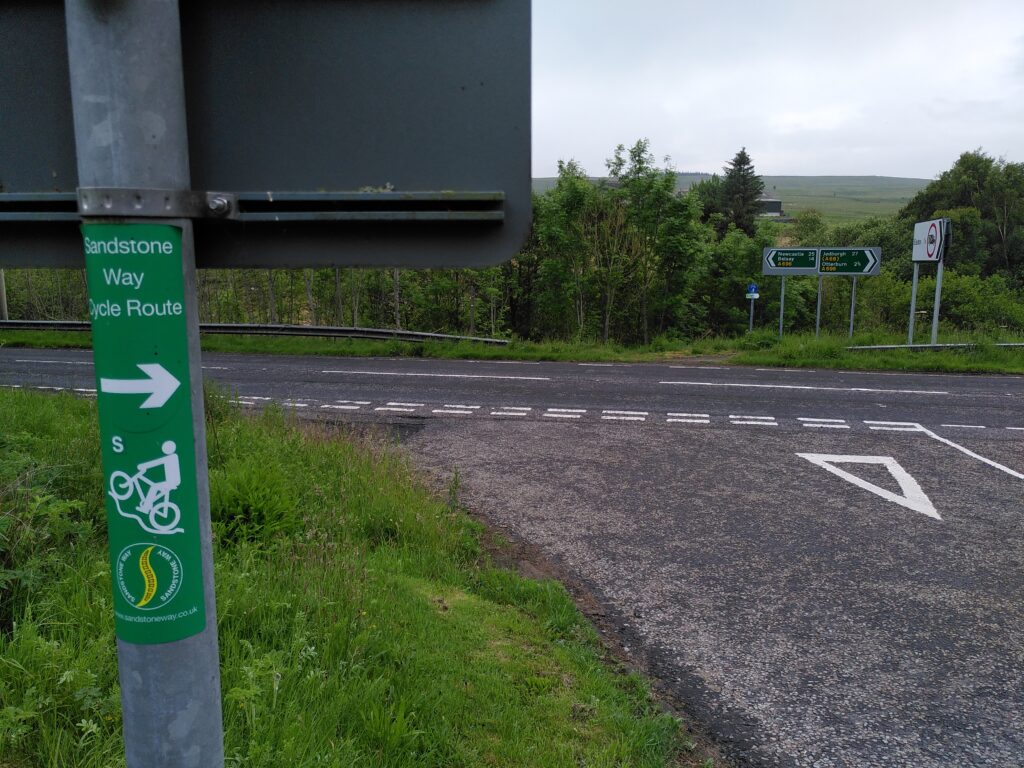
Then after this pinchpoint, it’s back to that Redesdale country tranquility again. A little bit of uphill, tree covered lane, which is fairly narrow if there IS traffic, though we met none.
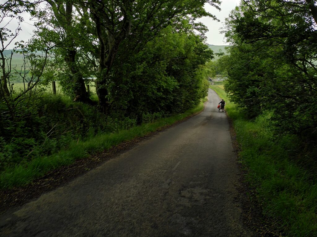
Then a properly delightful freewheel into the lush green of Elsdon where we stopped again on the Rede.
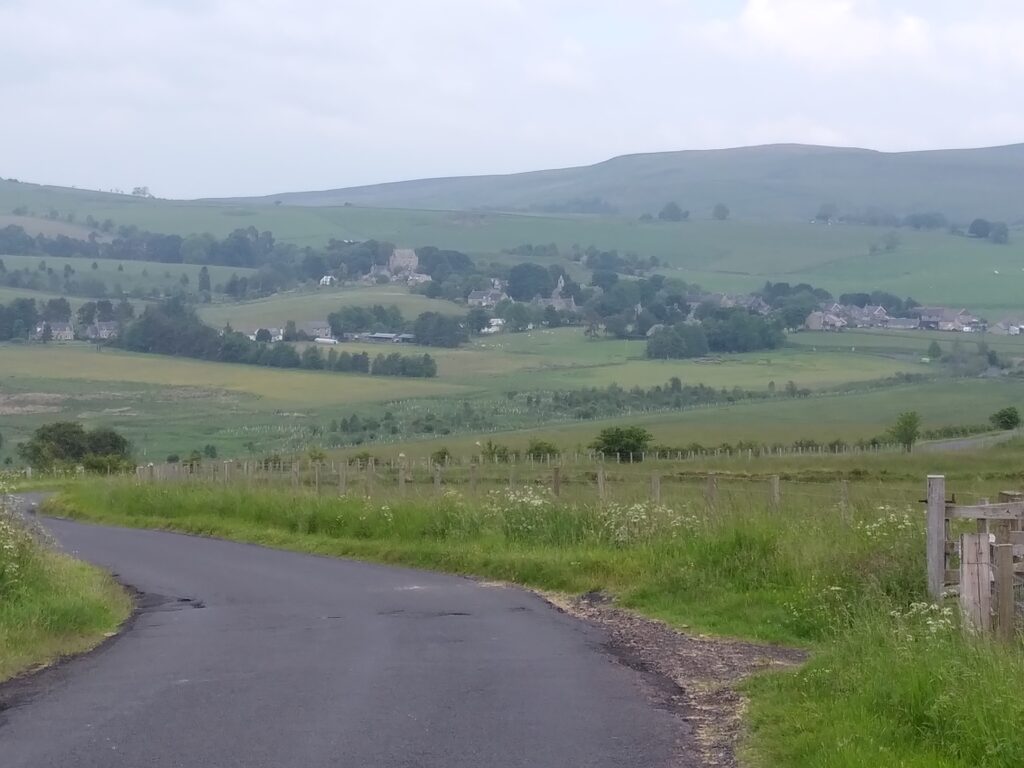
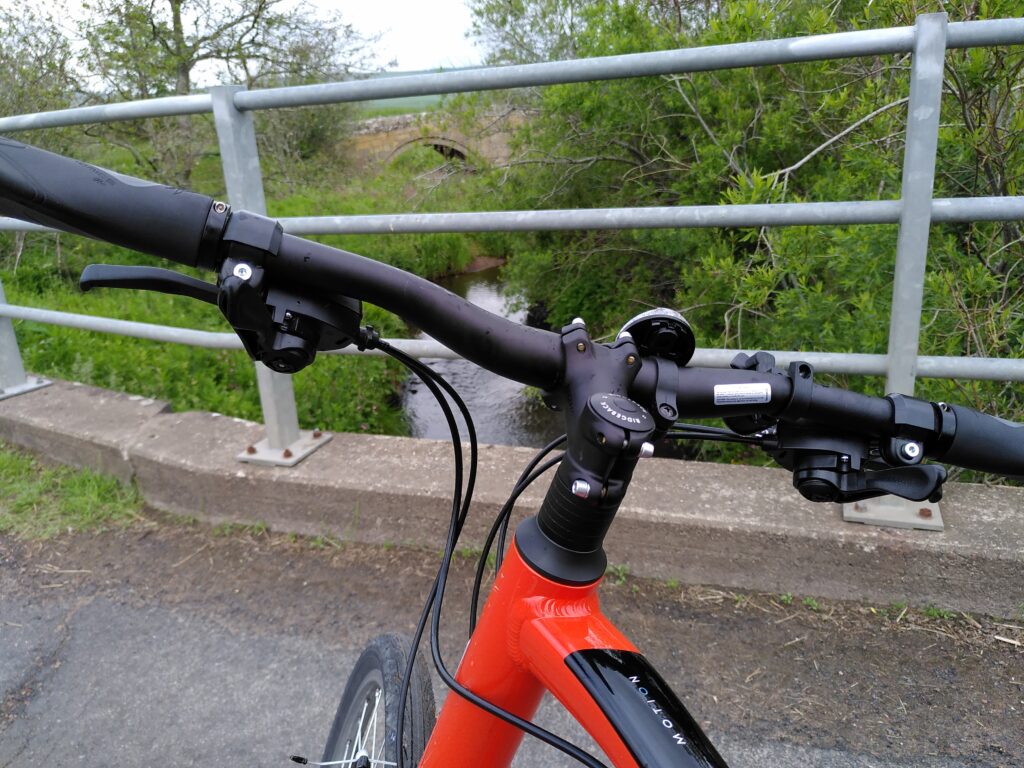
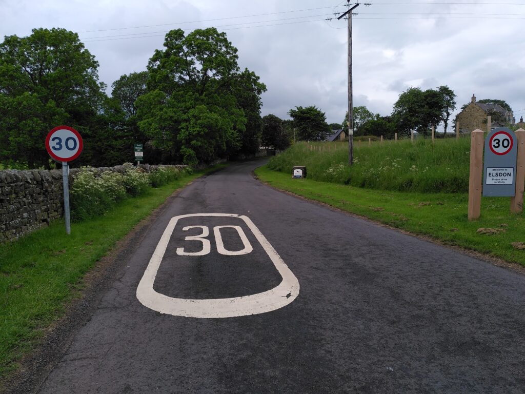
We cooked up some coffee on a camping stove under the great oak, but you will no doubt make use of refreshments from the cosy Bird in Bush or Bike Café.
Latest News & Events
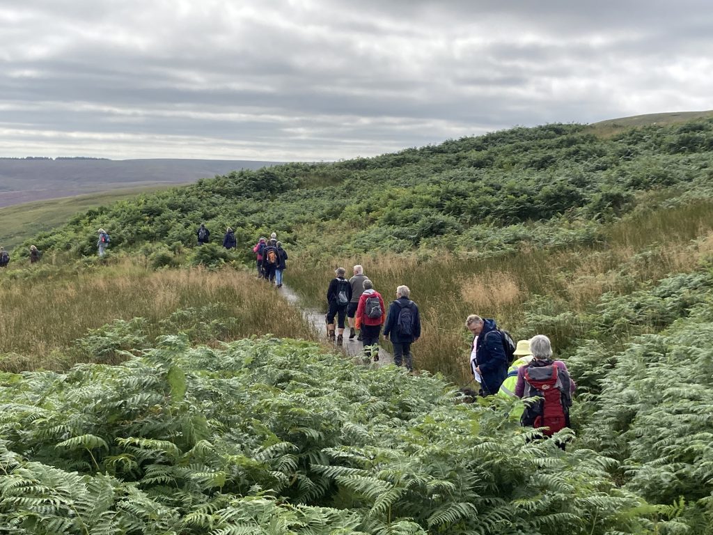
Great Days Out in Redesdale
July 18, 2023
Explore Redesdale with four itineraries for a great day out – Revitalising Redesdale designed to help visitors to Redesdale plan their visit
Read more